Montana's Pristine Lakes and Reservoirs
In a state famous for pristine creeks and blue ribbon trout streams, Montana also is home to hundreds of fantastic lakes and reservoirs. These vary in size, from the small local fishing ponds, to Flathead Lake, largest natural freshwater lake west of the Mississippi River.
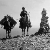
Montana’s lakes mimic its diverse landscape. High-mountain lakes dot the western and southwestern parts of the state, offering the dedicated hiker and fisherman many reasons to venture into the backcountry. But in the front country, natural lakes and reservoirs offer beautiful places for boating, camping and fishing.
In the central and eastern portions of the state, large reservoirs offer diverse warm-water fishing, sail boating and water skiing, along with camping, nature viewing and hiking.
These 10 lakes are some of the more popular around the state. But we haven’t nearly covered them all. For more information on lakes in a specific area, contact the local Montana Fish, Wildlife and Parks office, or go on the Web to: fwp.mt.gov/fishing/guide/default.aspx
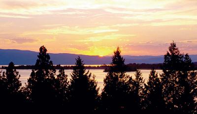
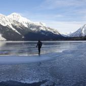
Flathead Lake
Location: 60 miles north of Missoula on Highway 93 and about 10 miles south of Kalispell. Highway 93 traces the west side of the lake through several towns like Lakeside, Sommers and Big Arm. Highway 35 follows the east side and goes through the community of Big Fork.
Activities: Boating, windsurfing, open-water kayaking, fishing, camping, hiking and nature watching.
Size: Flathead Lake is 28 miles long, up to 15 miles wide, 370 feet at its deepest and has about 185 miles of shoreline.
History: Flathead Lake was formed with the closing of the last ice age. It’s crystal clear waters and vast shoreline offer a wide variety of activities for any age.
Random Facts: Legend has it that Flathead Lake is home to a monster. Nearly 80 sightings have been reported since the late 1800s. For more information check out: www.flatheadlakers.org/recreation_culture/monster/index.html
General Information: The most popular portions of the lake to water ski, jet ski and sailboat are the south end near the town of Polson and the north ends near the towns of Lakeside, which is on the west shore, and Big Fork, which sits at the north east corner of the lake.
Montana Fish, Wildlife and Parks, as well as the Salish-Kootenai Indian Tribe own several boat launches, access sites and campground around the lake.
A handful of islands dot the lake. Most are private, but the largest – Wildhorse Island – is more than 2,100 acres, most of which are open to the public for hiking and wildlife viewing.
The lake is also home to the Flathead Lake Marine Trail, which is a network of access points, day-use and camping areas for people who sail or paddle on the lake. The trail is on the west side of the lake and is managed by FWP. Maps and brochures specify where access points are located and the distances between notable features, along with other important information. _
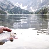
Fishing on Flathead lake is primarily for three species: lake trout (or Mackinaw), yellow perch and whitefish. Perch fishing is done mainly in the shallower sections of the lake, such as bays. Lake Trout are caught in the deep water primarily, though they do move into shallower water at various times of the year. Whitefish are caught readily in late Summer off of the rocky points around the lake in less than 100 feet of water. For all three species, artificial lures are most efficient and techniques vary between trolling and jigging depending on the time of year.
For specific fishing information, check with the local bait shops and marinas. For more information about access, camping and the marine trail, contact FWP in Kalispell at (406) 752-5501.
Lake Koocanusa
Location: Lake Koocanusa is located about 15 miles north Libby in the very northwest corner of the state.
Size: Koocanusa is a 90-mile reservoir that extends about 30 miles into Canada. The maximum depth is about 370 feet.
Activities: Boating, fishing, camping, nature watching, hiking, scenic driving and rock climbing.
History: Lake Koocanusa was established with the completion of Libby Dam in 1972. The dam impounds the Kootenai River and is 422 feet tall. The dam was a joint project between Canada and the United States.
Random Facts: The name Koocanusa comes from the name of the river it dammed – Kootenai – and the two countries involved in the project: Canada and the U.S.A.
General Information: The Kootenai National Forest manages most of the land around Lake Koocanusa. Visitors can camp in a hand full of developed and undeveloped campgrounds.
Rocky Gorge, Rexford Bench, Mariner’s Haven, Koocanusa Marina and Peck Gulch Campgrounds are all located off of Highway 37 on the east side of the reservoir. McGillivray Campground is located off the Forest Service road that follows the west shore.
The Lake Koocanusa Scenic Bi-way gives motorists a chance to see the lake from the road. The bi-way is 67 miles long and follows Highway 37 north from Libby along the east side of the lake to the Koocanusa Bridge, where it crosses the lake and follows the paved two-lane Forest Service road back to the dam.
Nature hikes are available at Peck Gulch and Rexford Bench, as well as several places along the west side of the lake. Rock climbing is also available near stone hill off of Highway 37.
Fishing is one of the most popular activities on the lake with the primary species being kokanee, rainbow, cutthroat and brook trout.
For more information, contact the Kootenai National Forest at: (406) 293-6211_or on the Web at: www.fs.fed.us/r1/kootenai/recreation/activitiesx/watersports/reservoir.shtml

Georgetown Lake
Location: Georgetown Lake is located in the southwest part of the state, about 18 miles west of Anaconda on Highway 1. It is near the Anaconda Pintler Wilderness area and offers visitors dynamic views of Montana’s high country.
Size: Georgetown Lake is about 3,000 acres in size, but is fairly shallow with depths of no more than 40 feet and much of the lake less than 20 feet deep.
Activities: Camping, hiking, boating, fishing and nature watching.
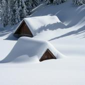
History: Georgetown Lake is the headwaters for Flint Creek. It’s a natural, high-mountain lake, which sits at about 6,300 feet. It is generally frozen over from the end of November to the middle of May and is popular for ice fisherman.
Random Facts: Georgetown Lake has special fishing regulations to protect spawning rainbow trout. Fishermen need to be sure to get a copy of Montana’s fishing regulations at a license dealer to find out specifics. During late spring, sightseers can pull off of Highway 1 and watch the rainbow trout spawn in the shallow water near the pump house on the west side of the lake.
General Information: Georgetown Lake is one of Montana’s most popular destinations west of the Continental Divide. Much of the shoreline is managed by the Beaverhead Deerlodge National Forest, which also operates three campgrounds around the lake.
In the Summer, Georgetown has quite a bit of boat traffic from both fishermen and water skiers. But fishing is the primary activity on the lake. The lake boasts of a healthy population of kokanee and rainbow trout. There are also a few brook trout, which must be released if caught. Since the lake is shallow, it is popular with fly fishermen, though casting can be difficult with a predictable late morning wind arriving nearly every Summer day.
Georgetown Lake has two marinas: Stuart Mill Bay and Georgetown Lake Lodge. A state campground is located at Stuart Mill Bay and a KOA Campground is located a Georgetown Lake Lodge.
Georgetown Lake is becoming more popular with bird watchers due to an abundance of waterfowl, shorebirds and raptors including loons, grebes, osprey and eagles. Most of the lake is accessible by either Highway 1 or Forest Service roads.
For more information, contact the Philipsburg Ranger District at (406) 859-3211.
Seeley Lake
Location: Seeley Lake is located about 50 miles northwest of Missoula on the Clearwater River. The town of Seeley Lake is located at the lake’s south end on Highway 83.
Size: Seeley Lake is a relatively shallow lake about 1,100 acres in size.
Activities: Fishing, camping, hunting, hiking, boating, horseback riding, ATV adventures, wildlife viewing and canoeing.
Random Facts: Norman Maclean, author of A River Runs Through It spent a lot time during his life on Seeley Lake, where his family owned an historic cabin.
General Information: Seeley Lake is one of several lakes located on the Clearwater River and the largest. The other lakes include: Rainy Lake, Lake Alva, Lake Inez and Salmon Lake.
The Lolo National Forest manages much of the land around Seeley Lake, including three campgrounds. These campgrounds are filled on a first-come, first-serve basis but there are group areas, which must be reserved.
Seeley Lake also sports a canoeing trail that starts about one mile north of the lake off of Highway 83 and follows the river into the lake. The trail is well marked and a fine place to see a variety of wetland birds and animals.
Fishing in the lake is a popular activity, with Northern Pike being the primary species of interest. The lake also holds kokanee, rainbow trout, yellow perch and sunfish.
The smaller lakes in the chain also have good fishing, boating, camping and nature viewing opportunities, but experience less pressure that Seeley Lake.
For more information, contact the Seeley Lake Ranger District at (406) 677-2233, or the Seeley Lake Chamber of Commerce at (406) 677-2880.
Canyon Ferry Reservoir
Location: Canyon Ferry Reservoir is located about 20 miles east of Helena off of Highway 287-12 just north of Townsend.
Size: The reservoir covers about 35,000 acres and is about 160 feet at its deepest. It is about 35 miles long and at the most, five miles wide.
Activities: Boating, waterskiing, sailing, nature watching, hiking, camping, and fishing.
History: Canyon Ferry Dam was built in the late 1940s and started producing power in 1953. It is the first dam on the Missouri River.
Random Facts: Canyon Ferry Reservoir is only 50 miles down stream from the headwaters of the Missouri River at Three Forks, Mont. The Bureau of Reclamation claims the dam has prevented about $126 million in flood damage since 1973.
General Information: Due to its close proximity to Montana’s capital city, Canyon Ferry is a busy place in the Summer.
On the south end of the reservoir is the Canyon Ferry Wildlife Management Area, which is operated by Montana FWP. This is a popular spot with birders and has a population of bald eagles and white pelicans.
Camping is also popular and 14 developed campgrounds are dispersed around the lake. Most of these are operated by FWP and cost $8 per night. The lake has two marinas – Kim’s Marina and Yacht Basin. Both have campgrounds and mooring facilities.
Canyon Ferry Reservoir has a good population of stocked rainbow trout, yellow perch, ling and walleye. Fishing on the lake gets good just after the ice melts in the spring and slows down during the heat of the Summer. But Fall fishing can be very good up until the lake begins to freeze over again.
For more information, contact FWP at (406) 475-3310.
Fort Peck Reservoir
Location: Fort Peck Reservoir is located on the Missouri River about 20 miles south of Glendive on Highway 24.
Size: Fort Peck is the fifth largest man-made reservoir in the country. When it’s full it is about 134 miles long and 220 feet at the deepest point near the dam.
Activities: Camping, boating, fishing, hunting, wildlife viewing and hiking.
History: Built during the Depression, at its peak Fort Peck Dam employed 11,000 people. The dam was the first in the upper Missouri River basin and is used for flood control, power generation, municipal water supply and to regulate water for river navigation in other states down stream.
Random Facts: When it’s full, Fort Peck’s shoreline is longer than the California coast.
General Information: Fort Peck has been greatly affected by a long-term drought and downstream water use. Water levels are continuing to drop, said Andrew McKean, spokesman for the FWP in Glendive. Many normal access points to the lake are unusable because of water conditions.
Some popular boat launches, like Crooked Creek and Fourchette Bay are dried up. Other access points are very weather dependent. Rain makes the ground around Fort Peck very slick, McKean said. Dirt boat ramps must be accessed when the weather is dry.
The most accessible boat ramps are at Fort Peck Dam, Rock Creek and Hell Creek.
Camping is abundant around Fort Peck Reservoir and much of the shoreline is open for primitive camping from your boat.
However, Fort Peck can become very rough with eastern Montana winds. So it is important to have all appropriate safety gear and be aware of the weather conditions.
Fishing is the most popular activity on the lake and Fort Peck is a world-class walleye fishery, McKean said. But other species are present too, including smallmouth bass, yellow perch, lake trout, Chinook salmon, and channel catfish.
For more information, contact the FWP office in Glendive at (406) 228-3700.
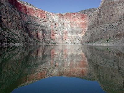
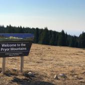
Bighorn Lake
Location: Bighorn Lake is located about 45 miles southeast of Hardin in southeast Montana, near the small town of Smith.
Size: Bighorn Lake is 71 miles long, extending about 30 miles into northern Wyoming.
Activities: Fishing, boating, waterskiing, camping, hiking, and wildlife viewing.
History: Bighorn Lake is actually a reservoir impounded by Yellowtail Dam, which was completed in 1965. The next year Congress established the 120,000-acre Bighorn Canyon National Recreation Area that encompasses the entire reservoir.
Random Facts: Two dams make up the compound at Bighorn Lake. Yellowtail Dam is the largest at 522 feet tall. Afterbay Dam, just downstream helps regulate the water released by Yellowtail Dam.
General Information: Bighorn Lake is a relatively undiscovered area in Montana. Yellowtail Dam compounds the Bighorn River and turned the river below the dam into one of the state’s premiere tailwater trout fishery.
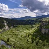
The lake extends south into Bighorn Canyon, which divides the Pryor and Bighorn Mountains. The remote narrow canyon is comprised of majestic limestone walls and is seen best by boat.
Campgrounds are available at a few places around the lake, including Afterbay and Barry’s Landing on the southern end of the lake. Access to the Wyoming end of the lake is through Lovell, WY.
Two boat-in only campgrounds are located in the Montana section of the lake – Black Canyon and Medicine Creek. Camping is allowed anywhere on the lake, but only 30 feet above the high-water mark.
For more information, look at the Web at: www.nps.gov/bica/index.htm, or call (307) 548-2251.

Other lakes of interest
Hyalite Reservoir - This picturesque reservoir is located high in the mountains outside of Bozeman. It is popular with people looking for an accessible, but primitive experience.
The lake has good populations of cutthroat trout and artic grayling. A no-wake rule is in place for the entire lake.
Hungry Horse Reservoir - This large reservoir is located about 20 miles east of Kalispell. The dam compounds the South Fork of the Flathead River and is a relatively primitive reservoir with several Forest Service campgrounds surrounding the lake.
The reservoir however has a unique fishery that is almost completely comprised of native bull and cutthroat trout, though there are a few cutthroat/rainbow trout hybrids in the system.
Holter and Hauser Reservoirs - These two reservoirs are located immediately downstream from Canyon Ferry Reservoir on the Missouri River. Both water bodies offer many activities including camping, fishing, wildlife viewing, and hiking.
Trout fishing in both reservoirs can be exceptional. The Missouri River below Holter Dam is well known as a premiere fly fishing river in Montana.
~ Greg Lemon is a freelance journalist in Hamilton, Mont. His work has appeared in several Montana publications. When Greg isn’ busy on an article, he’s generally doing research with a fly rod in hand and a pack over his shoulder.


Leave a Comment Here