Exploring the Northern Bitterroots
Five Hikes That Showcase the Splendor of the “Other” Bitterroots.
The southern stretch of the Montana Bitterroots tends to grab all the glory with their chasm-like canyons and cloud-catching crags; the iconic prominences of St. Mary Peak, Lolo Peak and their kin are plainly visible to travelers on Highway 93 through the Bitterroot River Valley. But the northern reaches of the Bitterroots — the area bounded roughly by Lolo and Lookout Passes on the Idaho/Montana border — offer their own quietly rugged charm. Dozens of lakes dot the landscape, many of them accessed via anyone-can-do-it trails. Although for the most part below treeline, the ridges boast expansive vistas, thanks to the catastrophic wildfires of the 1910 “Great Burn”, the 3-million-acre blaze that left a patchwork of forested and flower-clad ridges. The combination of quiet subalpine lakes and done-in-a-day hikes makes the northern Bitterroots one of the best spots in the state for a hiking vacation.


Five Hikes That Showcase the Splendor of the “other” Bitterroots.
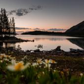
ST. REGIS LAKE
The headwaters of the St. Regis River, the snow-fed St. Regis Lakes provide icy refreshment all summer long. The 5.4-mile roundtrip trip to the lakes crosses and recrosses the shallow St. Regis River several times past old mining detritus and avalanche slopes that cascade with color — from the many-hued mountain flowers of early summer to the crimson and purple of huckleberries at its end.
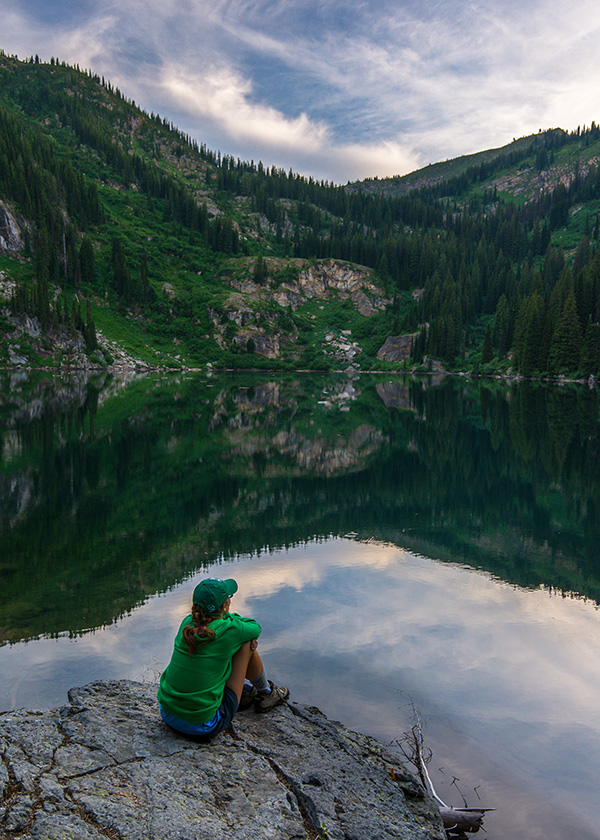
Subalpine firs and steep meadows surround St. Regis Lake, limiting shoreline access, but anglers willing to work the shore will find a hardy population of vigorous fish. Numerous tiny waterfalls from late-melting snowfields feed the lake and keep it bracingly cold; although the shoreline boulders and immediate drop-off in lake depth invite a dive, most hikers will be scrambling for shore after only a few seconds. From the lower lake, a faint boot path proceeds west a half mile to shallow Upper St. Regis Lake. From here, peak baggers can scramble out of the brush and up steep avalanche chutes to Stevens Peak, which peers down onto Upper Stevens Lake.
- Driving directions: From Interstate 90, take exit 0 (Lookout Pass) south. At the stop sign, turn left onto FR 7896. Continue 1 mile to a steep, rocky spur road on the right. If you don’t have a high-clearance vehicle park here; otherwise, proceed uphill 0.1 mile to the trailhead.
HAZEL AND HUB LAKES
Tiny Hazel and Hub Lakes occupy a steep, flower-choked slope high on the Bitterroot Divide. But they are only part of the scenic appeal of this six-mile roundtrip hike. The trail passes gargantuan cedars that escaped the 1910 Great Burn and a scenic view of the dramatic 60-foot Dipper Falls. Only occasionally steep, this hike is ideal for kids and canine companions. Hub is the smaller but more scenic of the two lakes, its shores, bounded by beargrass and huckleberries, perfect for a quick overnight stay. Ambitious hikers can climb a mile and another thousand feet to the Stateline Trail on the divide, and from there follow a faint footpath to Ward and Eagle Peaks for even better views of the endless pickets of the Bitterroots.
- Driving directions: From St. Regis, travel west on I-90 to exit 25 (Drexel). Get back on I-90 and head east to exit 26 (Ward Creek). (The Ward Creek exit is only accessible to eastbound travelers. Travelers heading west after the hike will have to drive east to exit 28 and turn around.) From exit 26, travel south on Ward Creek Road (FR 889) for 6.25 miles to its crossing of Ward Creek and the trailhead. The road shoulder accommodates parking for several vehicles.
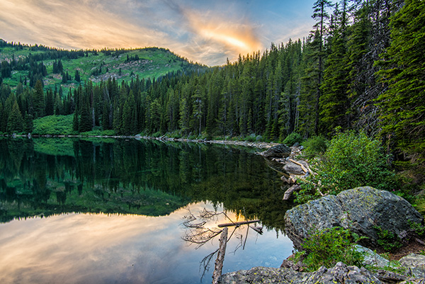
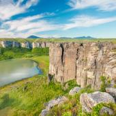
DIAMOND & CLIFF LAKES
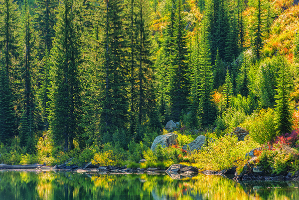
Accessed by an easy one-mile hike that traverses flower-filled avalanche slopes and passes crashing cascades, Cliff Lake provides a miniature dose of Bitterroots wilderness — with the corresponding lack of crowds to match. Beginning at the spartan but scenic Diamond Lake campground, the walk to Cliff Lake makes for a post-picnic stroll, and it’s short enough that backpackers can take kids and tenderfoots there. True to its name, Cliff Lake abuts a sheer cirque high on the Bitterroot Divide. Anywhere on the easily accessible shoreline will work for anglers — and for those angling for a view of icy-hued Eagle Cliff and its permanent snowfield. For the effort, there may be no better lake in the northern Bitterroots.
- Driving directions: From I-90, take exit 47 (Superior) south to Southside Frontage Road. Turn right (west) and drive 4.9 miles to Dry Creek Road (FR 342). Turn left and drive 9.9 miles, then bear left on FR 7843. At 3.5 miles, stay right, and at 4 miles reach the road’s end at Diamond Lake campground and trailhead.
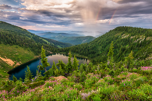
STATELINE TRAIL AND BONANZA LAKES
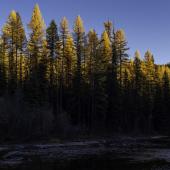
In 1869 Cedar Creek on the Bitterroot Divide separating Idaho and Montana experienced a miniature mid-winter gold rush, as nearly three-thousand miners flooded into the drainage, staking the entire gulch in one day; little paid out, but the miners left their mark, both on the ground and on maps, the name “Bonanza Lakes” commemorating a strike either real or hoped-for. Today, hikers can strike it rich with two subalpine lakes, each with its own character, in a region of the Bitterroots that hasn’t been mined heavily for recreation. The 5.5-mile roundtrip hike follows the Stateline Trail north from Cascade Pass through dry lodgepole forest, stunted subalpine groves and grassy meadows. It’s a wildflower bonanza: beargrass, harebell and western coneflower carpet the open subalpine forest. The sandy-bottomed lower lake is well-suited to swimming, and the shaded, huckleberry-laden shore is ideal for whiling away an hour or two. Another quarter mile beyond, the upper lake occupies a granite perch at the base of a vast, nearly vertical meadow. Save for one short steep stretch, the only difficult part of this hike is deciding which lake to choose.
Hikers interested in longer excursions can follow the portion of the border-tracing Stateline Trail along the Bitterroot Divide for dozens of miles of some of Montana’s finest ridgetop walking. For a pleasant base for day hikes on the Stateline Trail, check out the Missoula Lake Campground just west of the trailhead. It offers a handful of primitive sites among the trees; anglers can fish for feisty cutthroats from the brush-lined lake, a half-mile hike from the campground.
- Driving directions: From I-90, take exit 47 (Superior). On the south side of the freeway, turn left (east) on Diamond Match Road. Drive 1 mile, then turn right on Cedar Creek Road (FR 320). Drive 24.9 miles (paved for the first 2.8 miles, good gravel thereafter) to the trailhead at Cascade Pass on the Idaho/Montana border.
HEART LAKE
The intensity of the 1910 Great Burn scorched the soil such that, combined with the short growing season at elevation, little but ground-hugging tundra plants have managed to survive on the Bitterroot Divide. Elsewhere, drainages that escaped the conflagration harbors ancient cedars. The combination of landscapes — high and barren and low and lush — in such close proximity is one reason conservationists and the Forest Service have supported its protection as Wilderness for decades.
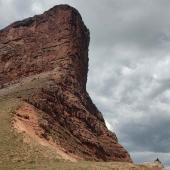
The largest subalpine lake in this part of the Bitterroot Range, Heart Lake is the centerpiece of the 250,000-acre Great Burn proposed Wilderness area. Heart Lake is the most well-known of the northern Bitterroots hikes, and while it’s by no means crowded, it’s one of the few places in the area that hikers can expect to see out-of-state plates in the summer. A three-mile hike accesses Heart Lake; another mile of walking deposits hikers at Pearl Lake, set in a granite bench high on the Bitterroot Divide. Either lake makes for a worthwhile spot to stretch legs, splash in the lake, or set up a tent for a weekend of Great Burn exploration.
- Driving directions: From I-90, take exit 47 (Superior). On the south side of the freeway, turn left (east) on Diamond Match Road (County Road 257). Travel 20 miles (paved for the first 6), past, Trout Creek campground, to the trailhead on the left side of the road. Parking on the opposite side of the road accommodates several vehicles.
VIDEO:A Northern Saw-whet Owl along the Bitterroot River:


Leave a Comment Here