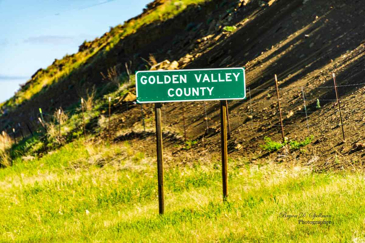
Get to Know a County: Golden Valley County
Born at the height of the homesteading boom (October 4th, 1920), Golden Valley County with its chamber of commerce name promised rich harvests, presumably of golden wheat, but the climate didn't live up to the farmers' needs, and the county's population has dropped fairly consistently since its first census in the county's tenth year. The 2020 census counted 823 residents, the lowest number in the county's history, but the 2024 estimate does show a 5% increase to 863, still lower than any previous census.
On October 4th, 1920, the Montana Legislature took land from Musselshell and Sweet Grass Counties to form the new Golden Valley County. If, like me, you're asking "Sweet Grass County?" I direct you to your Montana counties map. It becomes clear that while most of the land came from Musselshell County, there is a small parcel, south and west of the rest of Golden Valley County, that appears to have been cut from Sweet Grass. I can only assume that settlers in that area felt they would better served being closer to Ryegate than they were to Big Timber. Or am I the only one to get caught by things like that?
In any event, Golden Valley County was Montana's fifty-third county created. With an area of 1,176 square miles, it is fifty-second in area. And with an estimated 2024 population of 863, it is fifty-fourth in population. The county seat is Ryegate and the county number is 53.
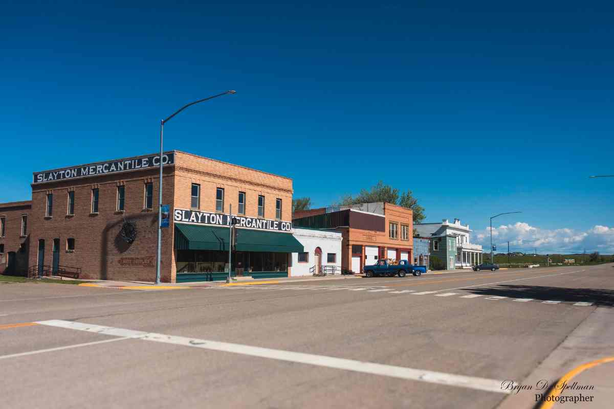
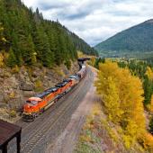
The Milwaukee Road (The Chicago, Milwaukee, St. Paul and Pacific Railroad) built its way across south central Montana in 1908, building depots roughly every ten miles. One depot was built in a rye field on the Sims-Garfield Ranch. As you had to go through a gate to get there, the railroad named the depot Ryegate. A town grew up around the depot, eventually including a hotel, café, newspaper, churches, grain elevators and saloons—this is Montana, after all. The town incorporated in 1917 and with the creation of Golden Valley County, Ryegate became the county seat.
The 1920 census counted 405 residents in Ryegate, the highest number in the small town's history. One hundred years later, the count had dropped to 223, and many of the early businesses had closed. Carroll Van West, writing in his blog MontanaHistoricLandscape, talks of the big "whammy" to south central Montana when in the 1970s the Milwaukee Road ceased operations and almost simultaneously Interstate 90 was completed roughly 45 miles south of US Highway 12. All Musselshell River Communities were affected, and Ryegate was no exception. In fairness, though, the town's population has been dropping almost from its beginning.
Roughly twenty-five years before the Milwaukee came to town, Montana pioneer Thomas C. Power built a stage line from Billings to Fort Benton in 1882. Finding a good ford on the Musselshell River, he built a stage stop, complete with stables, a mess house, a bunk house, a store and, of course, a saloon. The community that grew up here came to be known as Lavina, then Old Lavina when the Milwaukee built their depot a couple of miles to the east. New Lavina quickly eclipsed the original community and today is Golden Valley County's second town. Lavina's peak population was in 1960 when the census counted 212 residents. The 2020 census found only 136. Of the six properties in the county listed on the National Register of Historic Places, four are in Lavina, three within a block of each other on Main Street (Montana Highway 3).
My personal story includes several weeks (months?) in the mid-1950s. My father, an ordained minister in what is now known as the United Methodist Church (yes, I'm a PK—a Preacher's Kid), was serving as executive vice president of Rocky Mountain College in Billings. In addition to his academic duties, the church expected him to take on various ecclesiastic functions. I do not remember how long this particular assignment went on, but at one point he was asked to fill in as interim pastor at the Methodist yoked parish of Ryegate and Lavina. Every Sunday we would drive north on Highway 3 from our Billings home, so Father could preach in the two churches and Mother and I added to the congregations. Quite often a parishioner would invite us home for Sunday dinner. On one such occasion, while the adults conversed in a Lavina home, I was given leave to play outside. Our host had a bike that I was allowed to ride. It was what we then called "an English racing bike." I took off to ride around the town, but as I approached Highway 3, I couldn't get the bike to stop. No matter how many times I pressed backwards on the pedals, my feet just spun and the bike kept rolling toward the highway. I had never seen hand brakes before, and didn't know how to stop that bike. I do not remember what ultimately happened, but now, almost seventy years later, I'm still alive to tell the story.
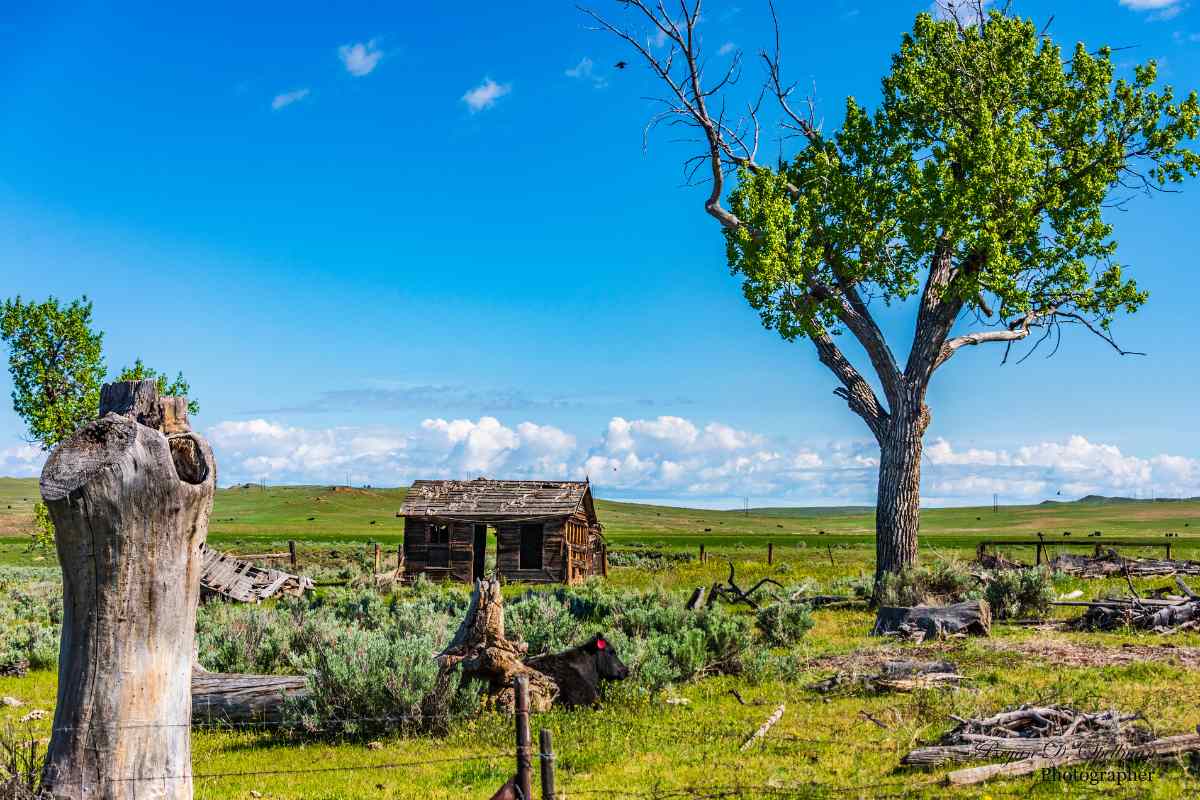
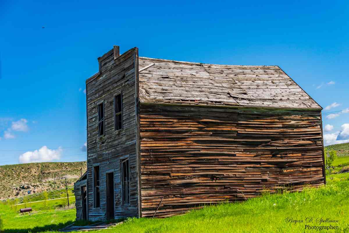
While today the county has only two towns, that was not the case in the early 1900s. With the Milwaukee offering special incentives, later called "propaganda" by many of the folk who fell for it, settlers began pouring in. The railroad promised fertile soil, abundant grass, and a "golden valley" in which to build a future. Eighteen towns sprung up between 1900 and 1920. Leland Cade has written a book entitled Ghost Towns of Golden Valley County. In its over 400 pages, native son Cade has collected newspaper clippings, oral histories, and other data outlining the rise and eventual fall of these communities. Admittedly, his eighteen towns include Ryegate and Lavina, but the story he tells of the other sixteen communities is remarkably consistent. In a nutshell:
- Settlers come by rail
- They build farms and farm towns
- They have two years (1914 and 1915) of amazing crop yields
- That is followed by years of drought, World War I, the Great Depression, and World War II
- The farms dry up, the economy collapses, the settlers leave, the town becomes a ghost town.
Of Cade's sixteen ghost towns, five show up on the DeLorme Montana Atlas, and only one on the 2021 Rand McNally Road Atlas. Should you take the back roads to visit these "towns," you might find an abandoned farm house, or the concrete foundation of a once-thriving business. Gary Splittberger, who posts his photos on the website Flickr under the name "Postmarks from Montana," has a photo album dedicated to Golden Valley County. He has visited many of these sites and posted both postmarks from closed post offices and photographs of landscapes where towns used to exist. Cade's book, by the way, makes for fascinating reading should you be interested in this particular section of Montana. It is available online through the Montana State Library's Montana History Portal.
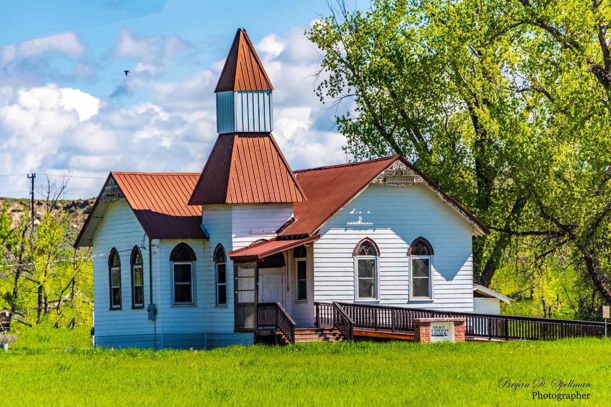
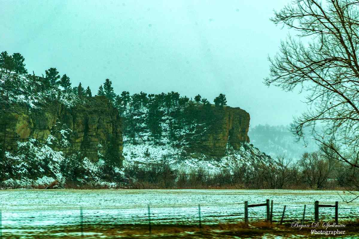
I always enjoy driving through Golden Valley County, and I recommend it to you as well. As you drive north from Billings on Highway 3, the land changes from the flat farmland north of the Rimrocks into rolling hills the closer you get to the Musselshell River. Once you turn west on US 12 at Lavina, you are driving between the river on your left, and more rimrock walls immediately to your right. Six miles west of Ryegate, if you turn off the highway, you will find yourself in what's left of Barber, one of the sixteen ghost towns. This town still has some life, though. Grace Lutheran Church has been refurbished and still serves as one of three mainline Protestant churches in Golden Valley County.


Leave a Comment Here