Travelers' Rest: A Study in Precision on the Lewis and Clark Trail

Photo by Maci Macpherson
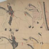
Nestled at the junction of U.S. Highways 12 and 93, Travelers’ Rest State Park and National Historic Landmark must be one of the most unassuming historic sites in the entire state of Montana. Traversed by Lolo Creek, much of the park sits in a low riparian area that floods every spring. The Séliš (Salish), Ql̓ispé (Kalispell) and Nimiipuu (Nez Perce) peoples have used the area as a thoroughfare and campsite for millennia, but white settlers didn’t have much use for a soggy bog that didn’t lend itself to farming. As a result, Travelers’ Rest looks much as it did when the Corps of Discovery passed through—once on September 9-11, 1805, on their way out to the Pacific, and again on June 30-July 3, 1806 on their way back to St. Louis.
As far as scenic vistas witnessed by Lewis and Clark, Montana has a lot better to offer than Travelers’ Rest. It boggles the mind to consider, as intimated in the National Register of Historic Places (NRHP) Nomination for the site, that the dreams of our young nation—the fantasy of an ideal topography suited to our economic ambitions as a budding world power—were shattered here in a humble marsh. When Lewis and Clark realized that they would have to traverse the Bitterroot Mountains on foot, they also had to reckon with the fact that the sought-after Northwest Passage was nothing more than a cherished myth.
But as important as this moment was to our national history, what earns Travelers’ Rest its distinction lies in the ground—the multiple lines of tangible evidence that point to the Corps of Discovery’s presence over 200 years ago. Notably the only archaeologically verified Lewis and Clark campsite in the country, Travelers’ Rest remained for decades one of those frustrating little Lewis & Clark mysteries poked and prodded at by scholars and amateur aficionados alike. When the landmark boundaries were first drawn in 1960, they were drawn to “hopefully” encompass the campsite’s actual location. At the time, it was thought that the campsite might have been closer to the mouth of Lolo Creek where it empties into the Bitterroot.

Photo by Dale Dufour
In 1998, Robert Bergantino at Montana Tech in Butte made an educated guess as to the location of Travelers’ Rest based on the Corps’ journals. Armed with USGS aerial photographs and maps, Bergantino used the Corps’ first-hand accounts to try and ascertain the camp’s location.
A concurrent study used aerial infrared photography to look for anomalies in the landscape. This team agreed with Bergantino that Travelers’ Rest had likely been farther upstream, but for a different reason. They surmised that, being led by a Native American guide along a Native American trail, the Corps would have camped alongside a Native American campsite (evidence of which they found with their infrared). Native American trails crisscross the canyons and ridges of the Bitterroots, and while most have been obliterated by logging roads, a couple miles of trail here and there can still be glimpsed in the mountains between Lolo and Missoula.
The speculation about Travelers’ Rest was finally resolved thanks to the work of the Travelers’ Rest Chapter of the Lewis and Clark Trail Heritage Foundation (LCTHF). Chuck Sundstrom twice served as the Chapter’s president and has retained extensive records of the chapter’s history. Founded in 1987, this small but dedicated group has worked over the years to develop interpretative programming about Lewis & Clark. Chapter members founded the nonprofit Travelers’ Rest Preservation and Heritage Association in 2001, now known as the Travelers’ Rest Connection. The Connection secured funds to buy the initial land for the park the same year.
Along with a team of volunteers, Chapter member and archaeologist Daniel Hall conducted several remote sensing investigations to pinpoint archaeological anomalies that could hint at a non-Native campsite location. Magnetometer, electromagnetic conductivity, and metal detectors were all used to scour the creekbanks for evidence of a von Steuben encampment pattern.

Hits With A Stick demonstrates primitive skills and tools. Photo by Dale Dufour.
Lewis and Clark were both military men and they ran the Corps of Discovery accordingly. They would likely have adhered to this popular encampment pattern strategized by Baron Frederick William von Steuben during the Revolutionary War and published in his “Blue Book.” The von Steuben encampment pattern basically amounts to a row of tents, a row of fire hearths behind, and behind that, a row of latrines (or sinks).
A defining requirement of the von Steuben pattern is that the distance of each row from the one previous be indicated in paces. The latrines required 300 paces distance, for example. Von Steuben was very concerned with camp cleanliness - luckily for the Corps, who were plagued with chronic diarrhea from their liberal consumption of "Dr. Rush's Bilious Pills," or "thunderclappers."
Hall located a number of suggestively arranged fire hearths that dated from the correct period. The team also found several artifacts that could be attributed to the Corps, including a blue bead, melted lead, and a tombac (metal) button. Most interestingly, the latrines they uncovered contained a not insignificant amount of mercury, a dead giveaway that the poop in the pit belonged to non-Native individuals.
Hall’s geoarchaeological investigations are the amped-up, high-tech version of “groundtruthing,” a long-used method to approximate the location of other Lewis and Clark campsites along the infamous overland stretch through the Bitterroots. Assayer, rancher and Lost Trail hot springs owner James West Gallogly grew obsessed with the Corps’ route through the Bitterroot Mountains and throughout the early 1900s walked hundreds of miles to retrace their steps using wayfinding techniques and cross-checking his route with the Corps’ journals. The very name “Lost Trail” commemorates the only two times the Corps got lost on their journey—both times, it happened in Montana.

Dan Hall supervises archaeology. Photo by Dale Dufour.
Knowing the precise location of Travelers’ Rest has not dramatically affected Lewis and Clark’s clout in America’s popular imagination. The NRHP nomination points out that pinpointing the campsite’s location was not done to glorify the Corps of Discovery, nor to dismiss the millennia of history as a cultural crossroads for Native Americans. Given how imprecise history is by its very nature—no one is ever telling the entire truth, and speculation is baked into the very fiber of historical research—one might well ask, so what? So what if we know exactly where Meriwether Lewis popped a squat?
One answer to the “so what” concerns public interpretation, or how history is presented to the public. When a person can stand in a place and know with confidence that they are standing in the same spot as some important figure did long ago, the past comes alive in a way that it wouldn’t otherwise. Such an experience makes history more immediate, tactile, and visceral—in short, it makes history feel more important. And for all historians, that is, after all, the light at the end of the tunnel: that people will realize how important the past is in understanding the present.
COVID-19 led to record visitation at Travelers’ Rest State Park, but also saw a drop in new memberships for the Travelers’ Rest Connection. The Travelers’ Rest Chapter for its part did not solicit membership renewals for the first time in its history. The two organizations officially merged last year, and continue to work towards mutual goals: rebuilding their membership base, and developing more history-based programming for the park.
Although Travelers’ Rest is managed by the state, Travelers’ Rest Connection Executive Director Molly Stockdale describes the state as the “hardware” of the park, and the Connection as the “software.” While the state ensures park functionality and maintenance, educational outreach is the Connection’s domain.
Stockdale explains that Travelers’ Rest has evolved to serve as a vehicle for three intertwined stories: that of the Corps of Discovery; the story of the Salish people; and the story of the area’s natural history. Twelve hundred local students will take field trips this summer to learn about all three stories, including Native American use of natural resources in the area to make tools, medicine, and shelter.
To plan your visit to Travelers’ Rest State Park, visit their website. Travelers’ Rest Connection will also host the 2023 Annual Meeting of the Lewis & Clark Trail Heritage Foundation in Missoula next June, so mark your calendars.
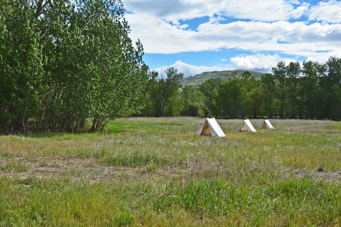
Photo by Dale Dufour


- Reply
Permalink