Get To Know a County: Toole County

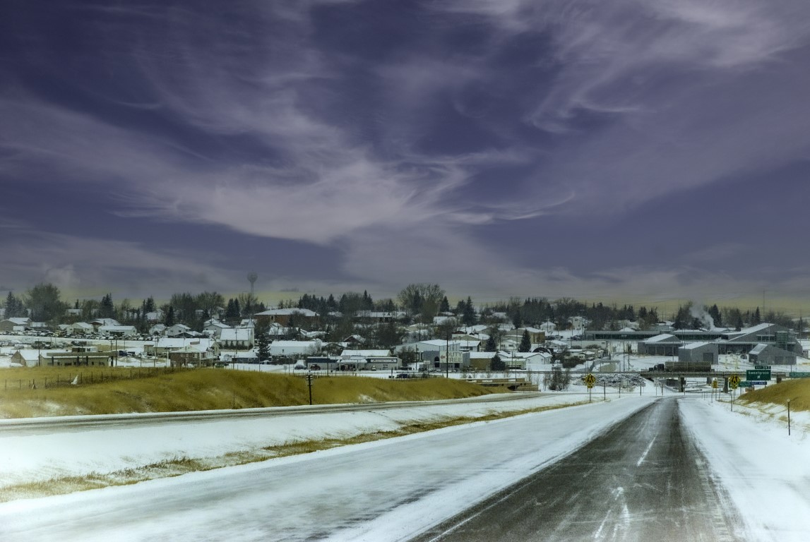
Photo by Bryan Spellman
Stretched between the Marias River and the Canadian border, Toole County covers 1,946 square miles, of which 30 are water (mostly Lake Elwell aka Tiber Reservoir). The 2020 census estimate showed 4,686 county residents, a drop of 12 percent since the 2010 census, and the lowest count since 1920.
Created in 1914 with land taken from Hill and Teton Counties, the county gets its name from Joseph Toole who served two terms as Montana’s governor. Toole was the first governor of Montana state, serving from 1889 to 1893. He ran again and won as Montana’s fourth governor, serving from 1901 to 1908.
From the beginning, Shelby has served as the county seat. It is the largest community and only incorporated city in the county.
Local lore says the city got its start when the Great Northern Railroad dropped off a box car and called it a station. That was in 1891.
A good place to get an overview of Toole County’s history is Champions Park in downtown Shelby.
While nominally referring to the 1923 heavyweight match between Jack Dempsey and challenger Tommy Gibbons, the park features Toole County in general. A replica of the boxing ring is at the park’s center, but panels describing the arrival of the railroad, homesteading on the Hi-Line, and the oil strike that brought industry to Toole County are on prominent display. The park is located on the 400 block of 12th Avenue North close to other attractions in Shelby.

Photo by Bryan Spellman
Of course, people traveled across Toole County before there were highways or railroads. One of Montana’s most infamous routes was the Whoop-Up Trail.
Connecting Fort Benton with Fort Hamilton, today’s Lethbridge, Alberta, the Whoop-Up Trail crossed Toole County. In 1993, two Toole County sections were added to the National Register.
The Rocky Springs Segment, near Kevin, still showed visible wagon ruts in 1993, although the springs themselves had dried up. Another section south of Shelby marks where the trail crossed the Marias River.
Kevin is a good place to start our drive around Toole County. Off any major highway, Kevin is 21 miles northwest of Shelby and 25 miles northeast of Cut Bank. Founded in 1910, the town took its name from Thomas Kevin, an official with the Alberta Railway and Irrigation Company. The town’s railroad depot, built by the Great Northern in 1903, is on the National Register. In 1922, just four miles north of town, oil was discovered. In the next five years, over 1,500 oil wells were drilled, with almost 900 of them productive. Oil still plays a role in the Toole County economy. And by the way, the town’s name is pronounced Kee-vin.
Driving northwest, we bypass the oil fields as well as Mud Lake and Fitzpatrick Lake. West of the town of Sunburst, the Jerusalem Rocks beckon. These hoodoos are like the Medicine Rocks of Carter County (See Distinctly Montana, Fall 2016, p. 91). The road is gravel and locals recommend a sturdy vehicle if you want to visit.
Continuing north, we could stop at Ross International Airport. Many airports dub themselves “International,” but Ross truly is. Located on the U.S./Canada border, it serves the towns of Sweet Grass (Montana)/Coutts (Alberta), and 25 flights a year stop to clear either U.S. or Canadian customs. There is a warning for pilots on the airport’s web listing: “CAUTION: International border marker five feet high short of the threshold of runway 25—don’t hit it!”

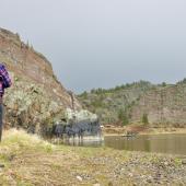
Photo by Bryan Spellman
Sweet Grass marks the northern end of Interstate 15. This border crossing is the most heavily used crossing in both Montana and Alberta. At the time of writing, the border remains closed to nonessential travel, so I suggest turning south on I-15 and heading to Sunburst.
The second largest town in Toole County, Sunburst started as a farming community which boomed with the discovery of oil. Sunburst even had a refinery and the high school teams are called the Refiners.
From Sunburst, we’ll drive east on Montana Secondary Highway 552 into the Sweet Grass Hills. The hills stand out as you drive the Hi-Line, but they deserve to be viewed up close. Our drive takes us into the foothills of West Butte (6,983 feet in elevation), around Gold Butte (6,512 feet) and past the ghost towns of McDermott, Gold Butte, and eventually Galata—not technically a “ghost town,” but it sure looks and feels like one. (Be warned, this road is not suitable for the faint-of-heart or a low clearance vehicle.)
From Galata, we turn west on U.S. Highway 2 and head to the Toole County Seat, Shelby. Along the way, we pass the location of two former communities, Devon and Dunkirk. While in Shelby, stop by the fairgrounds. Four northern Montana counties (Glacier, Liberty, Pondera and Toole) meet for the annual Marias Fair (named for the river that runs through all four), and the Dunkirk School may be the most notable building on the grounds.
Now showcasing 4-H and youth exhibits, the school moved from Dunkirk and currently serves the fair.
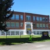
Downtown, visit the Marias Museum of History and Art (12th Ave and 1st St. North). From June through August, the museum is open six days a week (closed Sunday). The rest of the year, you’ll need to stop by on a Tuesday.
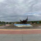
The Shelby Carousel lies nearby on 11th and serves as a rest area for both Interstate 15 and U.S. Highway 2. The carousel is next door to Champions Park.
Other opportunities for recreation include the Marias Valley Golf and Country Club and Lake Elwell, both south of Shelby, and the Road Runner Trail, a paved hiking/biking trail on the north edge of town.
In short, there’s plenty to do in Toole County, Montana, the Crossroads of the West.


Leave a Comment Here