The Shonkin Sag: One of the Most Important Geological Sites in the World

Montana is a study in contrasts. The western part of the state is covered with mountains, and this is where Montana gets its name. The east, however, is mostly known for its flat, wide-open prairies and plains. And this is where Montana gets its nickname, the Big Sky State, because there are no bigger, more brilliant skies than on Montana's eastern plains. Many cataclysmic events over millions of years, however, helped form the nooks and crannies in between where the mountains and plains meet. One of those places is called the Shonkin Sag. And though very few people know about it, every Montanan probably should.
The Shonkin Sag is a geological feature located in Chouteau County, Montana. It is well known locally for its unique landscape and extreme terrain. It is also one of the most important glacial and volcanic features in North America. Perhaps the world.
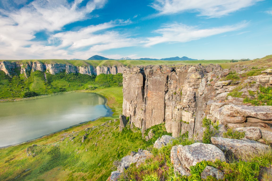
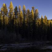
The Shonkin Sag is a large, deep, canyon-like depression flanked by ridges and cliffs. The steep, rugged walls create a striking contrast with the smooth valley floor below. The land on the plateau above this remarkable geological feature is flat and brimming with fields of wheat and cattle.
"The Sag," as some call it, was formed during the Pleistocene period, which occurred from about 25,000 to 15,000 years ago. But the Sag would not have been created if several other events had not taken place millions of years before.
First, a body of magma formed the Highwood Mountains. About 50 million years ago, an intrusive volcano ejected layers of magma into the overlying sedimentary rocks. The sediments were later eroded, exposing the more resistant magma layers that now form the backbone of the Highwoods. Second, about two and a half million years ago, we entered the Ice Age, when ice sheets advanced from the north and covered huge swaths of North America, including eastern Montana. As the ice sheets covering Montana formed and retreated every 100,000 years or so, the shape and course of the Missouri River also changed.

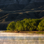
North-flowing rivers, like the Missouri, were dammed by the ice sheets and formed several large glacial lakes in the region. Glacial Lake Missoula in northwestern Montana is probably the best known glacially dammed lake, but there were others, including Glacial Lake Great Falls, which stretched from as far west as present-day Choteau, Montana and as far east as Geraldine. During the last ice age, the Laurentide ice sheet reached the north side of the Highwood Mountains and formed a barrier to the Missouri River. Glacial Lake Great Falls was created upstream of this ice dam.
At some point, or perhaps even repeatedly, the ice dam broke, and large amounts of water were released from the glacial lake. Glacial Lake Missoula abruptly released so much water that enormous floods carved the scablands and rolling hills of the Palouse region in eastern Washington. Glacial Lake Great Falls also catastrophically released, and huge amounts of water carved out the Shonkin Sag, including the dry falls which now form the west side of Lost Lake.
One of the most striking features of the Shonkin Sag is its deep canyon surrounded by tall cliffs. This depression was created by erosion and weathering, as water and wind gradually wore away at the softer clay and shale layers. The cliffs, on the other hand, were created by much older sandstone and volcanic rocks that are more resistant to erosion.
Cathy Whitlock is an earth scientist and Regents Professor at Montana State University. As a geologist she has spent much time studying the history of geology, vegetation, and climate in the western U.S. She even spent time studying pollen samples of sediment cores taken from the bottom of Lost Lake to reconstruct the vegetation history of the Shonkin region since the last ice age.
"The Shonkin Sag is an impressive landscape that was formed in a blink of an eye, geologically speaking," she said. "Many think of the landscapes created by the release of Glacial Lake Missoula, but the Shonkin Sag is another fantastic example of a glacial outburst flood. And when the ice dam broke holding Glacial Lake Great Falls, the result was an enormous flood with tremendous erosion."
No one knows for certain where the name "Shonkin" came from, but it is believed to originate from a Blackfoot Indian chief by that name. Indigenous people, such as the Blackfoots, lived in this area for centuries before the arrival of Europeans. The name "Shonkin" is derived from the Blackfoot word "shonkan," which means "to be brave" or "to be fearless." Though there is a very small town named Shonkin, it is also the name given to this part of Chouteau County along the edge of the Highwood Mountains.
An old grain elevator still stands today in the small town of Shonkin, which is about halfway between Geraldine and Highwood, Montana. The Chicago, Milwaukee, St. Paul and Pacific Railroad built part of the Milwaukee Road inside the Shonkin Sag, which included a stop in Shonkin.
The beautiful landscapes found along the Shonkin Sag have had a significant impact on art, too. Its rugged terrain, as well as the buttes and mountains that flank it, influenced the work of Charles Russell, one of the most famous Western artists of the 20th century. Before becoming an artist, Russell worked on a sheep ranch in the Judith Basin not far from the Shonkin Sag and the buttes nearby. The Sag's tall cliffs and deep canyons provided a sense of drama and grandeur that was central to his artistic vision. He used these dramatic landscapes to convey a sense of the vastness and wildness of the West, and to depict the struggles and triumphs of the people who lived and worked there.
Anyone can experience the grandeur of the Shonkin Sag, though many parts of this beautiful landscape are not easily accessible or are located on private land. But for the parts that are easily seen, all you need to do is take Highway 331 north from Belt and drive 16 miles in the direction of Highwood. There you will notice the terrain change suddenly and the elevation drop. This is where you enter the Sag. On your left and right you will see erosion and land "sluffing" from the hillsides as gravity, water, and time slowly erodes the outer rim.
Just before reaching Highwood, you will cross Highwood Creek. Though you can't see it from there, the Sag extends west along Highwood Creek another 10 miles and ends at the confluence of the Missouri River.

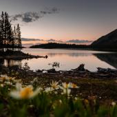
Farther ahead on the road between Shonkin and Geraldine is arguably one of the most breathtaking parts of the Shonkin Sag, called Lost Lake. Imagine walking across the flat open prairie and then suddenly, out of nowhere, stepping onto the precipice of a cliff and a huge hole in the earth. The lake below is surrounded by horseshoe-shaped walls of rock and stone, which rise 200 to 300 feet. These walls of shonkinite rock are known as Dry Falls, and they guard the perimeter of this lost and hidden place.
Lost Lake was formed 15,000 years ago with the rest the Shonkin Sag during the Pleistocene period when the largest glaciation reached the Highwoods. Paleo Indians, mammoths and mastodons would have roamed these parts. Huge amounts of water once flowed over the edge of these walls into the hole below. Some have even said this waterfall would have looked like Niagara Falls.
Though multiple ice ages probably had a hand in creating Lost Lake, when the final ice sheet retreated, the spigot of water was turned off, and the cataract feeding the falls dried up, leaving what we know as Lost Lake and the Dry Falls behind.
"There was a lot more water in eastern Montana than there is today," said Whitlock. "Can you imagine what a Paleo Indian might have thought standing near the Dry Falls with all that water rushing over the top? It must have been an impressive sight."
I had permission to visit and photograph Lost Lake some years ago. The following year, the landowners grew tired of people traipsing onto the property without first asking for permission and leaving trash behind. Today no one has access to the site except its landowners, the Bureau of Land Management and the State of Montana.
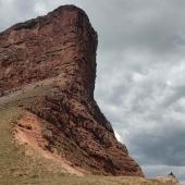
When you leave the area on Highway 80, south from Geraldine, look far off to the west just before you get to Square Butte, Montana. There you will see the rugged cliffs of the Shonkin Sag Laccolith, which is also a significant geological feature. This laccolith was formed by crystallization of magma slowly cooling below the surface of the earth at the same time the Highwood Mountains were formed. The Shonkin Sag Laccolith is notable for its size and the type of laccolith it is. It is made of several different types of rock, including granite, syenite, and diorite.

"It is not common to be able to view the cross section of a laccolith, such as the Shonkin Sag Laccolith," said Whitlock. "This laccolith is well known among people who study volcanos where the lava never made it to the surface. The chance to look at its minerals on the side of a laccolith almost never happens."
Once you drive past Square Butte you will then see the Chalk Cliffs on your left. This is a series of towering cliffs composed of cemented layers of sediment that were laid down on the bottom of the shallow sea that once covered the area. The thin strip of white rock in the middle is composed mostly of a marine fossil called Inoceramus, which is a type of clamshell. This is where the Chalk Cliffs get their name. They are also a popular spot for photographers and artists, as the cliffs provide yet another striking contrast to the surrounding landscape.
After driving through a valley filled with sagebrush, you will once again begin climbing out of the canyon and leave the Shonkin Sag behind. But before you do, you will pass through an area known to many as the Arrow Creek Slide. For more than 60 years it has been nearly impossible to keep asphalt on this section of Highway 80. What man has spent decades trying to build and maintain, Mother Nature has easily broken up and swept down the slopes of the Sag. Rugged topography and unstable soils kept pushing the highway farther down the Arrow Creek Slide, quite possibly leaving behind a dangerous surprise for drivers along the route. About ten years ago, tens of millions of dollars were spent to fix the problem, but no one knows if the fix will last. Those familiar with the story of the Shonkin Sag, however, would likely to bet against it.

Members of the geological community consider the Shonkin Sag one of the most significant geological landscapes in North America. Outside of Washington, Siberia, Iceland, and Alaska, there are few examples of laccoliths similar to the Shonkin Sag Laccolith anywhere in the world. And the story of the Shonkin Sag and Lost Lake is uniquely Montanan.
"The Shonkin Sag region is vastly understudied," said Whitlock. "It is significant and important to the history of Montana and should be protected."
Montana has 55 state parks, most of which serve a recreational purpose. Some have suggested that parts of the Shonkin Sag should be turned into a state park and saved from development because they hold so much educational value. When you stand on the precipice of Lost Lake, it's hard to believe this place. It reminds you both of Niagara Falls and a miniature Grand Canyon, and maybe it is something every future generation should have a chance to see.
One day I hope people much smarter than me find the funds and temerity to purchase Lost Lake and the Shonkin Sag Laccolith and turn them into a state park. Maybe Montana's 56th. Because if there is a landscape worth preserving anywhere in central Montana, whose impact has shaped the history of our entire state, it would be Lost Lake and this portion of the Shonkin Sag.


- Reply
Permalink