7 Day Hikes in the Swan Range
(Lotsa Lakes)
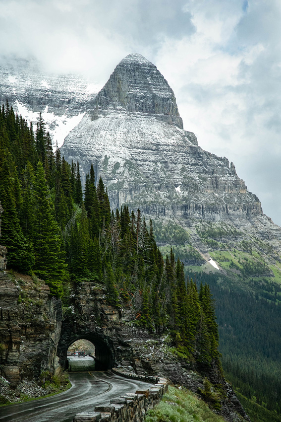
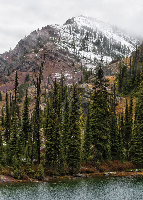
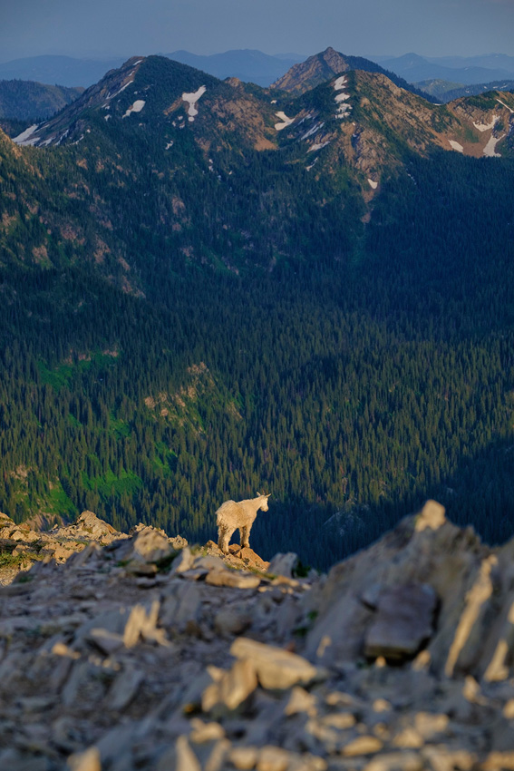
Forming the westernmost buttress of the broad expanse of peaks that comprises the Bob Marshall Wilderness Complex, the Swans lie within an hour’s drive of both Missoula and Kalispell but somewhat off the beaten path of the hiking masses. Here, stream-bottom trailheads access great swatches of subalpine meadows and dozens of tree-shaded tarns high above the Flathead and Seeley-Swan valleys. Aside from the justifiably popular Jewel Basin Hiking Area, the Swans promise solitude.
The seven hikes below sample the Swan Range. For more details for these and other hikes in the Swans, consult my new guidebook, Day Hiking Glacier National Park and Western Montana (Mountaineers Books).
1. Jewel Basin Loop
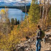
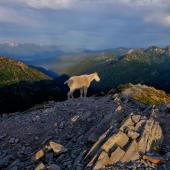
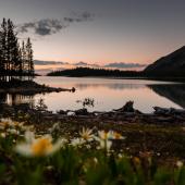
The Jewel Basin Hiking Area, east of Bigfork, is the centerpiece of the Swans: a clutch of subalpine tarns, from grassy lawns to deep lakes set under massive shadowed peaks, dotting wildflower-clad meadows and open ridgelines. Outside of Glacier National Park, this hiker-only trail system is perhaps the only place in western Montana where you’ll encounter a full trailhead parking lot. But the hiking hordes are adequately spread out over dozens of miles of singletrack, and nowhere more than on this 10-mile highlight reel of the Swan Range. From the popular Misery Camp trailhead, the Jewel Basin Loop climbs to a notch in the Swan Crest before descending to the shallow pair of Picnic Lakes, which sprawl out below a large cirque, before crossing crocus-filled meadows and spruce forest to Black Lake at the base of Mount Aeneas (a worthwhile hike in its own right). The loop continues to the shallow and grassy Jewel Lakes and the burnt snags and brush of Blackfoot Lake before climbing back to the Swan Crest and an aerial view of Twin Lakes before a return to Misery Camp.

Getting There From the junction of Montana highways 35 and 83 north of Bigfork, head east on MT 83 for 2.7 miles to the community of Echo Lake. Turn left (north) on Echo Lake Road and proceed for 2.2 miles, then turn right onto Foothill Road. After 1.1 miles, continue straight on Jewel Basin Road and follow this steep, washboarded road for 6.3 miles to the road’s end at Misery Camp trailhead (elev. 5750 feet).
2. Birch Lake
The foot-traffic-only Jewel Basin Hiking Area has a lake for every preference. Like lounging on the grassy lawn of a shallow tarn? Pick Picnic Lakes. How about plunging into a deep, granite-set pool? Choose Crater Lake. For an easy introduction to the calling cards of the Jewel Basin—quiet pools and copious flowers—hike the 6-mile roundtrip to Birch Lake. Aside from a brief ascent out of the trailhead, most of the hike follows a nearly level course as it sidehills across steep slopes awash in color from purple penstemon, lupine, aster, and more. The wildflowers thrive thanks to the copious snowfall of the Swans, the long north-south bulwark against the Bob Marshall Wilderness. Birch Lake occupies a broad, flat bench on the Swan Crest, its numerous spits and inlets sheltering semi-private swimming and tenting spots. Birch Lake is perhaps the busiest destination in the Jewel Basin, but ambitious hikers can leave the crowds behind and continue another three miles—with blooms and berries as added motivation—to the granite tub of Crater Lake. Rock outcroppings plunge immediately into cold, chest-deep water below; you’d be hard-pressed to find a better shore from which to cannonball.


Getting There See directions for Jewel Basin Loop, previous page.
3.Bond and Trinkus Lakes
Border Bond Creek’s meander to the green waters of Bond and Trinkus Lakes, tucked high on the meadowed slopes of the Swan Crest. You’re likely to encounter a steady stream of pack strings on the way to Bond Lake, owing to its fishing-friendly reputation. But abundant huckleberries, and the far-quieter shores of Trinkus Lake, an 11.4-mile roundtrip, should persuade hikers. Sitting in a slide-scoured glacial cirque, Bond Lake offers horse-trampled campsites sites amid lush meadow of high fireweed, false hellebore, false huckleberry, and cow parsnip. Fish dimple its surface. Trinkus Lake occupies a high hanging valley just below the flowered defile of the Swan Crest, its wind-driven surface a kaleidoscope of color reflecting off the steep brushfields above. Conservationists (myself included) would like to see this portion of the Swan Crest set aside as wilderness. Hikers looking for a shorter excursion can make the 4-mile roundtrip hike from the trailhead to Bond Creek Falls, which plunges some 20 feet through a narrow crack in the bedrock into an inviting plunge pool. Be aware, though, that the best huckleberries on the trail—and some of the best in the area—lie a mile or so past the falls.
Getting There Two miles south of Swan Lake on Montana Highway 83 (milepost 70), immediately south of the lower Bond-Trinkus trailhead, turn east onto Lost Creek Road (Forest Road 680). Drive 1.5 miles, then bear left onto FR 9507, continuing for 0.7 mile to the road’s end and trailhead (elev. 3350 feet).
4. Inspiration Point
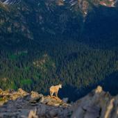
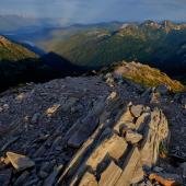
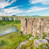
Survey the snow-covered shoulders of Swan Peak from this former lookout site on the tundra-clad hummocks of the Swan Crest. Although you may be inspired to choose this hike for its high-elevation trailhead, be warned: Inspiration Point manages to sneak in the Swan Range climbing quota between the beginning and end of its 12.4 mile round-trip distance. Fortunately, the scenery accompanying the trail’s capricious gains and losses in elevation is uniformly spectacular, from the early-summer color of glacier lilies on the wildflower-spangled Napa Ridge to old-growth spruce in the sheltered drainages of the Swan Crest. A former lookout site, 7628-foot Inspiration Point surveys the western Bob Marshall Wilderness and the White River Syncline to the east. Inspiration Pass is the ingress for a south-to-north ridge run along the Swan Crest Trail, which continues all the way to Columbia Mountain past charming wooded tarns and flower-draped slopes.
Getting There From Montana Highway 83, 13 miles south of Swan Lake (between mileposts 58 and 59), turn left (east) onto Goat Creek Road (Forest Road 554). Drive 3.6 miles, keeping left at a signed junction at 1.6 miles, then turn left onto Napa Point Road (FR 554). Continue 1 mile, then turn right onto FR 10505 and drive 6.9 switchbacking, occasionally rough miles to the road’s end at Napa Point and trailhead (elev. 6423 feet).
5. Upper Holland Lake Loop
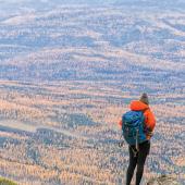
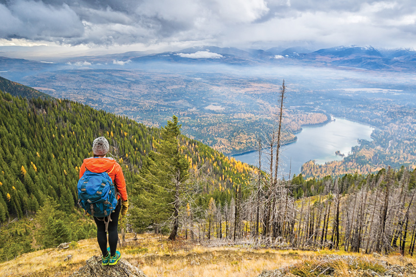
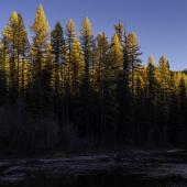
The larch-fronted shores of popular Holland Lake in the Seeley-Swan valley north of Missoula are the departure point for a classic 12-mile backpacking loop high into the Swan Crest. The six-mile hike to Upper Holland Lake parallels the crooks and cascades of Holland Creek; backward glances reveal Holland Lake below and the snow-clad panorama of the Mission Mountains to the west. Upper Holland Lake is a miniature version of its low-elevation kin, a wooded pool with a moose-friendly marsh at the inlet. But the star is Sapphire Lake, actually a pair of pretty infinity-pool tarns perched on stacked bedrock benches a mile or so of climbing beyond Upper Holland Lake. The lakes mirror the layer-cake pyramid of Little Carmine Peak directly across the Holland Creek drainage; to the east unfurl the endless bastions of the Bob Marshall Wilderness. A popular horse-packing portal into the Bob Marshall Wilderness, the Upper Holland Lake loop can get crowded on summer weekends. Autumn, when the crowds have thinned and the western larch put on their golden show, is the time to go. Be aware that snow stacks up in the Swans beginning in early autumn; bring waterproof boots and plan for minor route-finding challenges on the leeward side of the Crest.

Getting There From MT 83 20 miles north of Seeley Lake (just past milepost 35), turn east on Holland Lake Road. Drive this good gravel 3.9 miles, past the Holland Lake day-use area and Holland Lake Lodge, to the road’s end and trailhead (elev. 4060 feet).
6. Holland Falls
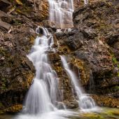
Looking for a shorter alternative to the Upper Holland Lake Loop? The popular 3-mile roundtrip hike to Holland Falls suits families or hikers looking for a leg-stretcher after a drive up the Seeley-Swan Valley. Tracing the pine-shaded shoreline of Holland Lake, the trail gains little elevation as it goes past several inlets and bays toward the lake before climbing in earnest through aspen-shaded talus slopes to the waterfall. Holland Falls plunges some 30 miles into a broad basin, where large rocks and storm-felled logs provide picnic perches. A tangle of user-created paths climb the steep walls of the catch-basin, but spray from the falls and loose soil make the going treacherous. Several rock outcroppings afford aerial views of the lake, where one can watch for osprey clawing cutthroat out of the lake’s blue depths.


Getting There See directions for Upper Holland Lake Loop, page 13.
7. Pyramid Lake
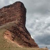
A popular portal for pack trains headed into the southern interior of the Bob Marshall Wilderness Complex, Pyramid Lake also offers easily accessible high-country fare for hikers. Using a system of old roadbeds, the trail never exceeds a moderate grade as it climbs through second-growth timber and tumbling subalpine meadows with views of the Seeley Lake drainage and the snow-girded Missions beyond. Subalpine trees surround much of the shoreline of Pyramid Lake, but the lake doesn’t feel closed in, possibly because Pyramid Peak’s exfoliated slopes sit so close. Well-used campsites perch on low rocks on the southwest shore of the lake, which recedes quite dramatically late in the season. The worthwhile tradeoff for late-season hiking is the striking larch display in October—when your hunting-season attire should be as bright as the larch needles.
Getting There At the north end of the town of Seeley Lake, turn east off Montana Highway 83 onto Morrell Creek Road (Forest Road 477). Drive 1.1 miles, then bear left onto FR 4353. Continue 5.9 miles, then turn right onto FR 4381. Continue 3 miles to the large trailhead loop (elev. 5240 feet).


Leave a Comment Here