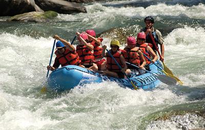
Whitewater Hydrotherapy
Rafting Montana's Wild Rivers
What to do in Montana...
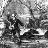
Montana’s rivers have a special kind of historical significance, as the waterways played a key role in the Treasure State’s early development. In early times the rivers carried only Indians and intrepid explorers. Later, they brought miners, cowboys, sodbusters, soldiers, and shopkeepers. Indian bullboats and French pirogues were gradually replaced by flatboats and even steamships.
One reason the rivers were so important is that they are easily navigated. Despite the cold waters and rapid flow, most Montana rivers can be floated by people with only moderate river skills.
The majority of Montana’s rivers lie in the mountainous western portion of the state, where they flow down broad valleys between mountain ranges. In arid eastern Montana where only a few major rivers flow, the streams are generally broad and flat as they cut through open grassland and sagebrush country. While the sparkling western streams may be more spectacular, the eastern rivers have a quiet beauty and offer better opportunities for solitude.
On most Montana rivers, whitewater sections occur primarily in narrow canyons and last only a few miles. While much of the whitewater is extremely challenging, most runs can be covered in a day. Wondering what to do in Montana during the Summer-time? Look no further than our beautiful rivers!
[The above and following excerpts are from Paddling Montana by Hank Fisher (Falcon Publishing, Inc.]
Madison River
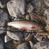
The Madison River runs 133 miles from the Wyoming border to its juncture with the Jefferson River to form the Missouri River near Three Forks. It is rated Class I except for two sections (below Quake Lake and Bear Trap Canyon) that have difficult rapids.
The river winds through highly scenic country, with the lofty Madison Range to the east and the sage-covered foothills of the Gravelly Mountains to the west. Access is excellent and much of the land bordering the river is publicly owned. There are numerous picnic areas, campgrounds, and fishing access sites. Inner tubers enjoy the section from Warm Springs to Greycliff.
Hazards: Fast water with frequent rocks in the upper river. Low bridges with debris around the pilings, logjams, snags, and a diversion dam below Varney. Bear Trap Canyon and the difficult water below Quake Lake. In the summer the water can become very low. The Bear Trap is also known for its rattlesnakes, ticks, and poison ivy.
The Bureau of Land Management has published an excellent map of the river and the Bear Trap Canyon called the Bear Trap Canyon Wilderness Visitor’s Guide. Also available are an excellent topographic map as well as photos of the approaches to the four major rapids. It’s available free of charge by writing to the Bureau of Land Management.
Gallatin River
The Gallatin River springs from the snow-clad peaks of the Madison and Gallatin mountain ranges and courses for more than 90 miles before joining the Madison and Jefferson rivers at Three Forks. The Gallatin comes close to being an alpine stream as it spills through the scenic Gallatin Canyon, where frequent rapids alternate with deep, green pools alive with trout.
The Gallatin River actually consists of two forks, the East Gallatin and the West Gallatin rivers. Because the West Gallatin is substantially larger, it’s generally recognized as the mainstem river. While both branches are floatable, they differ sharply in character.
The East Gallatin River, a major tributary of the Gallatin, is also floatable for about 20 miles from Bozeman to its confluence with the mainstem near Manhattan.
The upper 40 miles of the Gallatin River contain some of Montana’s very finest whitewater with an abundance of technical rapids, tight turns, big rocks, and large waves. Some stretches have nearly continuous action. Almost all the Gallatin’s whitewater is easily accessible as the river flows mostly through public land and generally runs close to U.S. Highway 191. Even though the Gallatin is a small river, it can sustain good boating well into the summer.
Level of difficulty: A difficult whitewater stream with Class II, III, and IV rapids in the upper 40 miles. Very technical, experts only at high flows. Hazards: Large rocks, tricky currents, large waves, diversion dams, and logjams on the Gallatin. Barbed-wire fences, sharp bends, low water, and narrow brushy channels on the East Gallatin.
Milk River
Named for its whitish color, the lengthy (527 miles) Milk winds through remote prairies and seldom-visited cottonwood bottoms alive with wildlife—from the confluence of the Middle and South forks north of Browning to the Missouri River near Fort Peck. It is Class I its entire length, suitable for beginners except at high flows. Therefore, it’s an excellent choice for a long-distance float trip.
While not a classic beauty, the Milk River contains some of the least-explored water in Montana. Those who seek solitude, wide open spaces, and excellent wildlife viewing opportunities won’t be disappointed.
While most people think of the Milk as a cloudy river, it flows out of the undisturbed slopes of Glacier Park as a clear mountain stream. It then enters Canada north of Cut Bank. After a 100-mile loop, the Milk returns to Montana a changed stream. The Canadians aren’t to blame, however, as most of the siltation is natural. While it was once thought the Milk’s bluish-white color resulted from glacial till, it’s now thought the color originates from fine sand picked up in a deep gorge near Writing-on-Stone Provincial Park, Alberta.
For more information on these rivers contact: Yellowstone Raft Company, Big Sky; Madison River Fishing Company, Ennis; The Tackle Shop, Ennis; FWP, Bozeman; BLM, Dillon.
Brennan’s Wave, Clark Fork River, Missoula
Strap your kayak on your bike trailer (like the fuel conserving locals) and pedal downtown under the Higgins Street Bridge; there you’ll find the man-enhanced Brennan’s Wave (named after world-class Missoula kayaker Brennan Guth, who lost his life in 2001 while kayaking in Chile). Paddlers in sparkling helmets and sub seven-foot playboats line up in the mega-eddy, waiting their turn to cartwheel in this well-sculpted souse hole.
Alberton Gorge, Clark Fork River
Located just 30 minutes west (downstream) of Missoula, this friendly, class II-IV stretch is a whitewater playground for both seasoned river rats or green-horned novices. Springtime in “The Gorge” brings big water and once-a-year play spots that only appear at highest flows. But, as summer comes into bloom, the Clark Fork is quick to shed its chilly, chocolate-colored winter weight, making way for warmer, green waters and legendary surf waves like “Fang” and “Cliff Sides.”
Swan River, Big Fork
The raucous “Wild Mile” of the Swan runs adjacent to downtown Bigfork and offers thumping, “convenient” whitewater on the edge of this charming community. Serving up non-stop, class III-IV+ churning rollers and glassy waves, this run connects the Swan Reservoir with Flathead Lake.
Kootenai River, Libby
The Kootenai is one of the biggest rivers under the Big Sky. This-1.5 mile, class III-V run begins with an optional 20-foot waterfall and is followed by monster waves, cavernous holes, and the infamous “Superwave,” one of the fastest, most dynamic surf waves in the Northwest.
Middle Fork of the Flathead River, West Glacier
The Middle Fork of the Flathead, a designated wild & scenic watershed, offers nearly 75 miles of dreamy whitewater. From the narrow, class III-IV pool-drop rapids of the Upper Middle Fork (accessible only on foot, horseback or in a small, fixed-wing airplane), to the easily accessible, class II-III whitewater and playful surf waves of John Steven’s Canyon, the Middle Fork offers a range of aquatic experiences.
When participating in whitewater activities, remember to keep yourself safe and leave no trace of your presence. Because playing on a river brings you closer to many natural beauties and inhabitants, hopefully you will also feel a personal stake in protecting the rivers’ future.
Leave a Comment Here