TOPPING OUT: 5 One-Day Mountain Hikes
Montana’s wealth of public lands supports a strong outdoor industry and is one of the main attractions for relocation of retirees and businesses, not to mention it is part of the “Blue Sky Payment” that all residents enjoy daily.
The following is a short sample of the many hikes available to anyone who wants to venture off the pavement. Most hikes require nothing more than a good pair of walking shoes, a daypack with a few basic items like a water bottle, map, raincoat, bug repellant, snacks, your camera and your desire to slow down and see wild nature. It is a good idea to carry a can of bear spray whenever you are in grizzly country, although much of Montana is not occupied bear habitat.
1. COTTONWOOD LAKE
CRAZY MOUNTAINS PROPOSED WILDERNESS
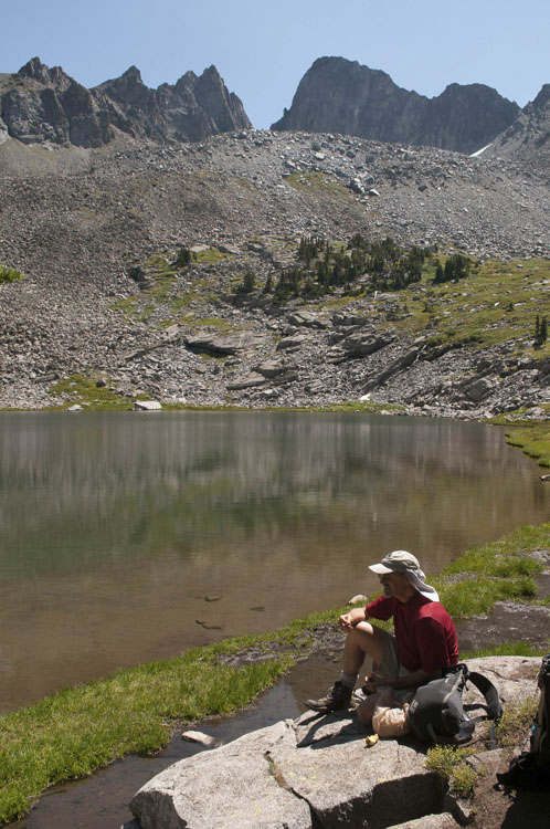
The Crazy Mountains near Livingston rise dramatically from the Yellowstone River to 11, 214-foot Crazy Peak, more than 7,000 feet, about the same elevational rise as the Tetons above Jackson Hole!
The Crazy Mountains were severely glaciated creating jagged peaks and beautiful cirque lakes, one of which is Cottonwood Lake. Indeed, a few relict glaciers remain hidden in pockets, including above Cottonwood Lake.
The 11-mile round trip hike to Cottonwood Lake is a leg stretcher, but the scenery is as good as anything in Glacier National Park. To find the trailhead go six miles east of Livingston to Highway 89 which you follow north towards the rural community of Clyde Park. Just beyond Clyde Park, the Cottonwood Bench Road (Forest Road 198) heads east towards the range. Follow twists and turns of the road towards the Ibex Ranger Station. At a road junction on Upper Cottonwood Road, instead of continuing on to Ibex Cabin continue straight 3 more miles to the Trespass Creek/Cottonwood Trailhead.
The first couple of miles are on an old jeep trail, now closed. At about 2 miles stay left on Trail 197. The next stretch of trail is fairly steep, but that provides lots of opportunity to stop and catch your breath and to enjoy the outstanding mountain scenery. The trail slope eventually moderates as you pass through countless flowery meadows the rest of the way to the lake, which sits in a steep glacial bowl.
For more information contact Custer - Gallatin NF, Yellowstone Ranger District 5242, Highway 89, South Livingston, Montana.
2. GRANDVIEW POINT
BIG SNOWY MOUNTAINS PROPOSED WILDERNESS
The Big Snowy Mountains are an isolated mountain range in Central Montana near Lewistown that includes a 98,000-acre proposed wilderness study area. The mountains are lush and have extensive forests including magnificent aspen groves at lower elevation, and a high 12-mile-long alpine-like plateau lying at 8,500-8,700 feet in the center of the range.
The Snowies are located between Great Falls and Billings and frame the Judith Basin and Judith River. The Judith River was named by Captain Lewis of Lewis and Clark for his sweetheart Julia. The Judith Basin is a “snow trap” that created lush grasslands for herds of bison and later large cattle ranches.

Although there are many opportunities for longer hikes, the short Grandview Trail 403 trail climbs 3.5 miles steeply up a ridge to a spectacular view of Crystal Lake as well as the Judith Basin. If you have a bit more energy you can continue another 1.5 miles to West Peak, the highest point in the range. On a clear day you can see 100 miles!
To find the Grandview trailhead from Lewistown, go west on Hwy 87 to the Crystal Lake Road. Follow this gravel and paved road 22 miles to Crystal Lake and campground.
Lewis and Clark NF, Judith Ranger District, 109 Central Ave, Stanford, Montana.


3. TIMBERLINE LAKE
ABSAROKA BEARTOOTH WILDERNESS
The Absaroka Beartooth Wilderness lies immediately north of Yellowstone National Park and is one of the largest wilderness areas in the country at 937,000 acres. The heavily glaciated landscape contains Montana’s highest summits, including 12,799-foot Granite Peak. One of the attractions of the wilderness are the more than a thousand lakes and ponds that dot the high plateaus. One of the more easily reached high alpine lakes is Timberline Lake which lies below majestic 12,547 Silver Run Peak, sixth highest in Montana.
To find the trailhead which is just outside of Red Lodge, Montana drive 11 miles on the West Fork Road (Forest Road 71) to the parking area.
Although the lake itself lies within the AB Wilderness, the 9-mile round trip hike starts out in a timbered corridor. At 3 miles or so you will reach a trail junction where you keep left for Timberline Lake. In another mile you reach Gertrude Lake, a beautiful spot in its own right, but the best is yet to come. Continue up to Timberline Lake at 9,500 feet which as the name implies has shrubby whitebark pine lying just at timberline.
For more information contact Beartooth Ranger District 6811, Highway 212, South Red Lodge, Montana.

4. HEART LAKE
GREAT BURN PROPOSED WILDERNESS
In 1910, the largest forest fire recorded in the western United States roared across northern Idaho and western Montana. Dubbed the 1910 Burn, the fire charred between 3 and 3.5 million acres in two days of hot, dry weather with hurricane force winds. The fire helped to create support for the U.S. Forest Service as the primary forest fighting agency and solidified its position as a federal land management agency.
The blaze produced one of the rarest habitats in the West—the snag forest that results from high severity burn. Shrub habitat generated by the fire supported burgeoning elk herds and superb fish habitat. It also created spectacular treeless alpine-like terrain at much lower elevations than would otherwise occur. Reflecting the areas high precipitation levels, one of the special attributes of the area is the occurrence of western red cedar. Lying west of Missoula in the northern Bitterroot Mountains along the Idaho-Montana border is the lake-studded 250,000-acre proposed Great Burn Wilderness.

To find the trailhead drive west from Missoula on I-90 to Superior, Montana. Cross under the Interstate and follow Diamond Match Road (County Road 257) to Forest Road 250. It is 21.7 miles from Superior to the Heart Lake Trailhead.
The hike to Heart lake is approximately a little more about 5 miles round trip. Trail 171 follows Trout Creek forested bottom nearly to the lake. Around the 2- mile mark, you climb six switchbacks up to the cirque harboring the lake at 5,760 feet. Mountain goats are often seen on the cliffs above the lake.
For more information Contact Lolo NF, Superior Ranger District 209 West Riverside, Superior, Montana.
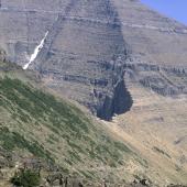
5. PIEGAN PASS
GLACIER NATIONAL PARK
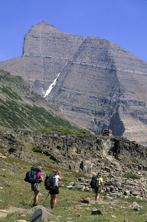
George Bird Grinnell, a well-connected bird enthusiast with a Ph.D. from Yale and friend of Teddy Roosevelt, visited the area now Glacier National Park in the 1890s. Grinnell began a campaign to create a park. which he deemed the “Crown of the Continent”. Today, Glacier National Park is an economic engine for Kalispell and Montana as a whole, and if once you hike here, you will understand why it is fitting that the park’s moniker is “Crown of the Continent.”
The Hidden Lake Trail by Logan Pass is the most popular in the park, but no less spectacular trail is the Piegan Pass Trail located along the east side of Logan Pass. The trailhead is located three miles east of Logan Pass and 13 miles from the east entrance. The round-trip hike to the pass is 9 miles with an elevation gain of more than 1700 feet. Due to the high amounts of snow that fill the Logan Pass area, this trail is usually not accessible until sometime in July.
The trail will take you through subalpine forests, high mountain meadows filled with wildflowers to a stunning wall of mountains at the pass. The views of Piegan Mountain and namesake Piegan Glacier as well as the view down Cataract Creek at the top of the pass is every bit as spectacular as anything you will encounter in Glacier. Keep in mind that the last half mile or so is above timberline, and you will be exposed to more wind and weather.


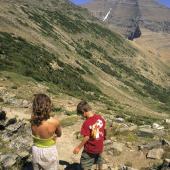
The hike begins a gradual uphill hike through forest with numerous views of surrounding mountains. At about 1.2 miles, turn left (north) at a trail junction and continue the uphill climb. The trail continues through meadows to Preston Park where you reach another junction and keep left now traversing across the open slopes of Cataract Mountain. To describe the vistas from the treeless pass as breathtaking is not hyperbole. After soaking in the alpine scenery return the way you came.

Leave a Comment Here