Get To Know Wheatland County
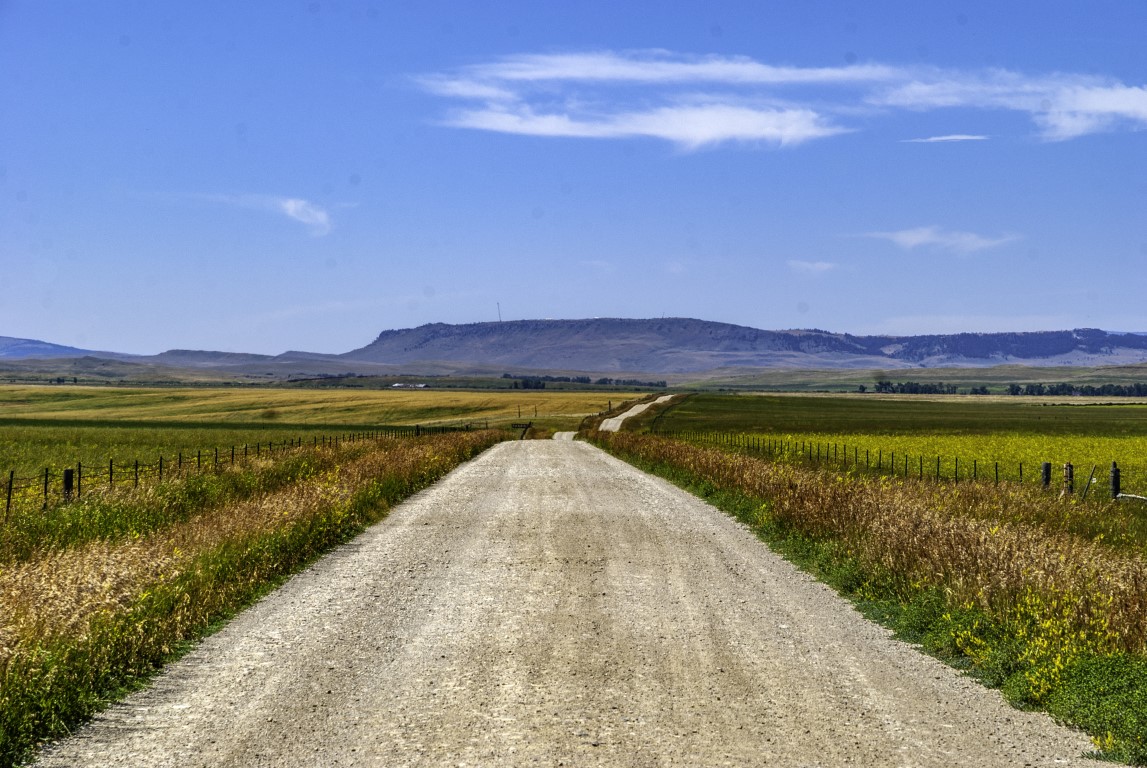
Photo by Bryan Spellman
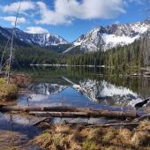
The Montana State Legislature created Wheatland County on February 22, 1917, using land taken from Meagher and Sweet Grass Counties. From the beginning, Harlowton has served as county seat. The county covers 1,428 square miles, of which five square miles is water. The 2020 population was 2,069, the lowest count in the county’s hundred-plus-year history. Located just southwest of the geographic center of Montana, Wheatland County is mostly square in shape. It lies between the Little Belt and Big Snowy Mountains in the north and the outliers of the Crazy Mountains in the south.
Two U.S. highways cross the county. US-12 runs east-west, connecting the county with Helena to the west, and Miles City to the east. US-12 runs parallel to the Musselshell River, the longest river that is entirely within the state of Montana. US-191 runs north-south and connects with Lewistown and Big Timber. Where the two roads cross lies Harlowton, the county seat.
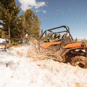
It should surprise no one that a county named Wheatland has agriculture as its primary industry. Fully one-quarter of county workers are involved in agriculture, forestry, fishing and hunting, according to the most recent city-data.com statistics, and that applies to both males and females. The same source tells us that the average size of county farms is 5,163 acres and that wheat grown for grain was harvested from 37,204 acres. That’s over 58 square miles. Montana State University, using data from the 2017 Census of Agriculture, says that 95% of Wheatland County land is used for agriculture, more than any of its neighbors. And while we’re on the topic, the 2017 Census of Agriculture shows that while forage (hay, etc.) was the number one crop by acres, wheat for grain came in second.

Photo by Bryan Spellman
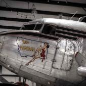
If agriculture is king in Wheatland County, Harlowton is, or at least was, a railroad town. Founded in 1900 as a station on the Montana Railroad, the town took its name from the president of that line, Richard A. Harlow. The Chicago, Milwaukee, St. Paul and Pacific, known as the Milwaukee Road, absorbed the Montana Railroad, and made Harlowton one of its main switching points. In fact, when the Milwaukee decided to electrify its service across the Rocky Mountains, Harlowton was where the trains left their steam (later diesel) locomotives and added the electric engines that led the trains westward.
The last electric locomotive used on that line sits proudly in a park right on 2nd Street NW, AKA U.S. Highway 12. The Milwaukee put its electric locomotives to rest in 1974, and by 1980 had ceased all operations west of Miles City.
I have always felt that Montana missed an opportunity when almost all the Milwaukee’s roadbed reverted to private ownership and the bridges and tunnels closed. Our neighbors to the west, both Idaho and Washington, turned the abandoned beds into hike/bike trails.
What an experience that could have been for Montanans. Harlowton, at least, has Smoking Boomer trail, a work in progress that commemorates both the Milwaukee Road and the dog that entertained passengers on the Milwaukee’s Hiawatha. In time, the trail may extend all the way to Two Dot, sixteen miles west of Harlow.
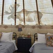
Before we leave Harlowton, check out the Upper Musselshell Museum dedicated to the history of Wheatland County and its residents. The Milwaukee Depot is now a museum as well, and well worth a visit. Should you want to spend the night, I would recommend the Graves Hotel.

Photo by Bryan Spellman
Built originally in 1909, and almost forgotten as Harlowton reeled from the demise of the Milwaukee, today the Graves is under new ownership, serving breakfast and lunch, and offer several rooms for overnight guests.
In addition to the Graves, Yelp.com lists two other restaurants in Harlowton, as well as one each in Judith Gap, Shawmut, and Two Dot. All got at least 4-star reviews from the limited number of people who have traveled through and stopped for a meal. One of the bucket list items on the Great Falls Tribune’s list of things to do in Montana is “Stop for a burger at the Two Dot Bar.”
Harlowton is the largest community in Wheatland County, but it’s not the only place to visit. One of the most iconic names in Montana is Two Dot (or Twodot, depending on what source you reference). Two Dot got its name from the brand cattleman George R. Wilson used—two dots side by side. Wilson donated the land for the town in 1900. In time, the town had a station and electrification plant for the Milwaukee Road, a bank, and the aforementioned Two Dot Bar. Hank Williams Jr. even sang about the town on his Strong Stuff album. Two Dot is sixteen miles west of Harlowton, just off US-12.

Photo by Bryan Spellman
At the northern end of the county, straddling US-191, is Judith Gap, located in the gap between the Little Belt and the Big Snowy Mountains. Originally a stage stop called Ubet, the town of 110 (2020 Census) is home to one of the largest wind farms in the U.S., the Judith Gap Wind Farm. Back in 1958, as a favor to a friend, my father drove a VW Beetle—newly imported into Montana at that point—from Billings to Great Falls. Driving through Judith Gap, the wind picked up that car and set it on the wrong side of the road. My father was not impressed.
East of Harlowton, along US-12, is Shawmut, a Census Designated Place home to 51 residents in 2020.
Shawmut has had a post office since 1885 and is named for the Shawmut Peninsula where Boston’s first streets were laid. It is the place to get off the highway if you’re planning on some recreation at Deadman’s Basin. A man-made reservoir off the Musselshell, Deadman’s Basin has a campground and offers trout fishing, although the website BigSkyFishing.com recommends you bring everything you need as services are few and far between.

Photo by Bryan Spellman


- Reply
Permalink