
Get to Know a County: Pondera County
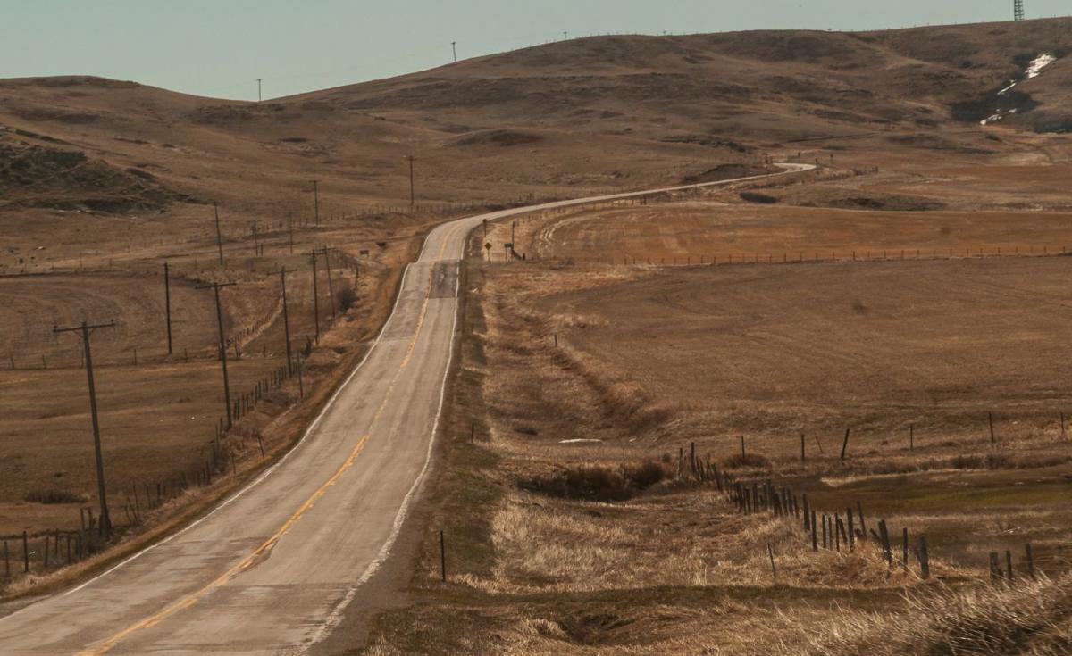
On February 17th, 1919, the Montana Legislature took the northern portion of Teton County, and created two new counties—Pondera and Glacier. A small section of western Chouteau also became part of Pondera County. With the creation of the new county, Conrad became the county seat. The 1920 US Census counted 5,741 people living in the new county, a number that has stayed relatively stable over the hundred years since. 1960 showed the county's largest count at 7,653, and the 2025 estimate of 6,072 puts Pondera at 33rd of Montana's fifty-six counties. The county covers 1,640 square miles, placing it at 44th in size. The county number is 26.
Montana has four counties with names derived from the French language. Out-of-staters (and even some Montanans) have trouble pronouncing three of them. Only Teton (from the French téton—nipple) seems clear to Americans. Chouteau (show-toe) and Wibaux (wee-bow) are French family names, and then there's Pondera.
Everyone seems to agree that Pondera is the phonetic transcription of a French phrase, but which phrase? The most common explanation is Pend d'Oreille (hangs from the ear), the name the French trappers gave the Ql̓ispé people, a Salishan tribe who lived west of Flathead Lake across western Montana, northern Idaho, and northeastern Washington. My problem with this explanation is that the county is in Blackfeet country, and the Ql̓ispé and Blackfeet were not the best of friends. Also, by 1919, the Ql̓ispé were firmly established on the Flathead Reservation west of the Divide.
The explanation I prefer is that the original French was Pain d'orée (golden bread) which fits because Pondera County is in the heart of Montana's Golden Triangle, so named because of the miles after miles of wheat fields that cover the area. My problem with this is that I am not sure how strong the French influence was in the early days of Pondera County. The Pondera History Association Files do contain papers about the Métis (people of mixed French Canadian and Native American ancestry) as well as papers about Belgian settlers in the Valier area. In any case, whichever explanation pleases you, the proper pronunciation for the county name is pon-duh-RAY.
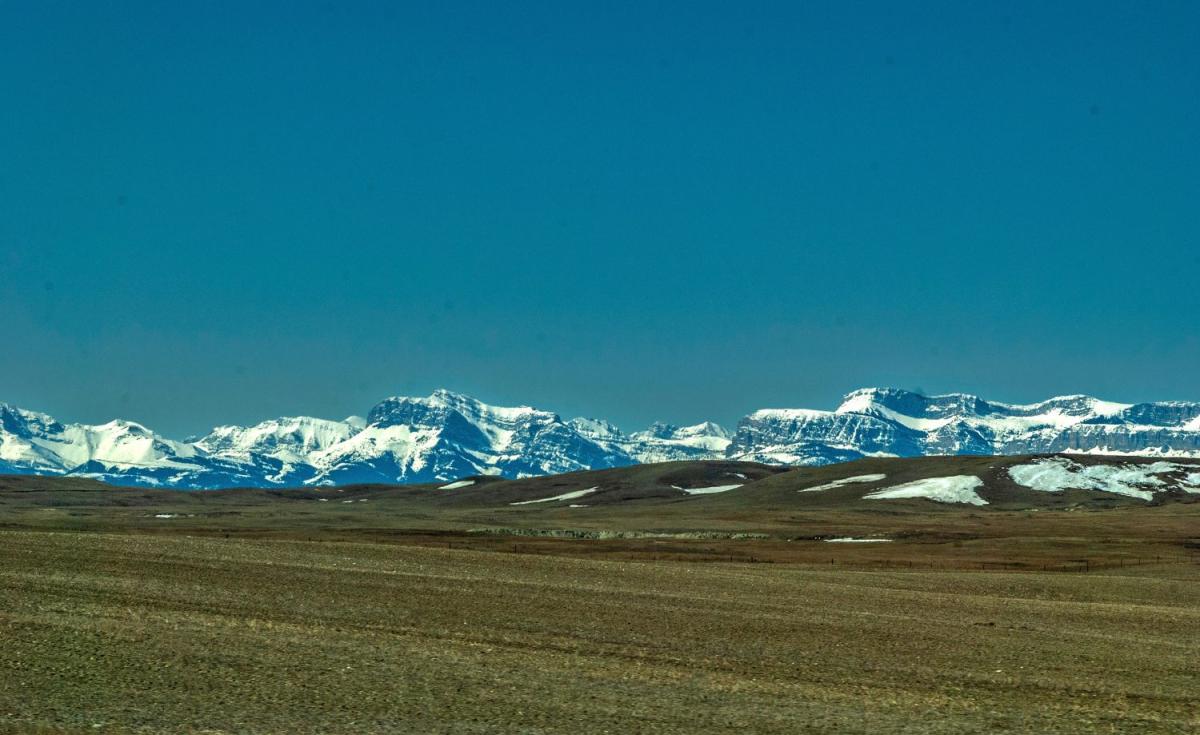
As noted above, this part of Montana was home to the Blackfeet people. For much of their history, the Blackfeet were the primary inhabitants of territory that stretched from South Dakota's Black Hills to the Rocky Mountain Front and from north of Edmonton, Alberta to Yellowstone National Park. As white settlement moved west, the tribe was pushed both west and north. Treaties of 1855 established reservations across the Pacific Northwest. One of these was for the Blackfeet. As in so many other cases, white settlement reduced the size of this reservation to its present boundaries. With the creation of Glacier and Pondera Counties, the Blackfeet Indian Reservation lies in both counties. According to the Pondera County planning documents, 15.5 percent of Pondera County land is within the borders of the Reservation.
In the northwestern corner of the county, near where U.S. Highway 89 crosses the Two Medicine River, there is a turnout on the west side of the highway with a large metal tipi frame and some history signs. Two of those signs are titled "From One Perspective" and "From Another Perspective." Between the two is a third sign titled "A Dispute Over Horses and Guns." The site and the signs remember the July 26, 1806 night when the Corps of Discovery and a group of Blackfeet camped together along the Two Medicine River. During the night, the Blackfeet stole guns and tried to steal the expedition's horses. In the ensuing skirmish, two of the Blackfeet were killed, one by Meriwether Lewis himself. In the two year, four month Corps of Discovery journey, the expedition crossed eight thousand miles round-trip from St. Louis to the Pacific Coast. This was the only time that blood was shed and Natives died.
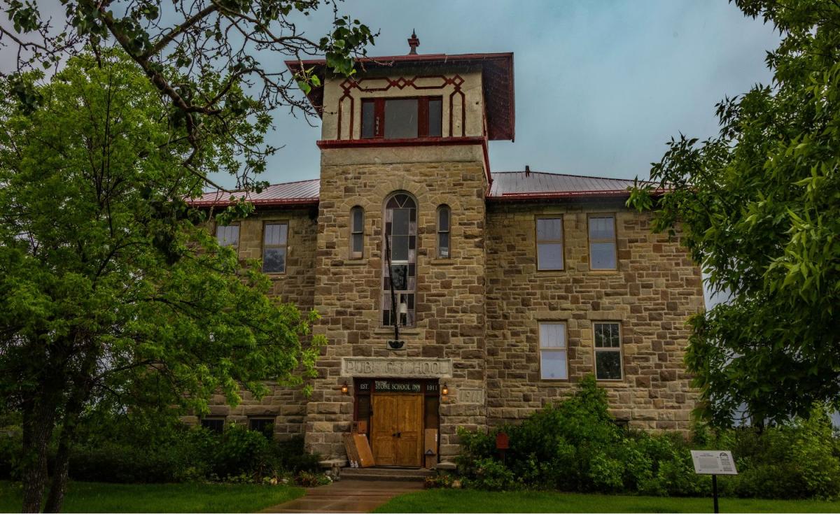
The Two Medicine Fight Site is one of four Pondera County locations on the National Register of Historic Places. Two others are in Conrad and one in Valier. The Valier School was built in 1911 and operated as the public school until 1952. The three-story stone building was most impressive in a town that to date has never had a population of over 710.
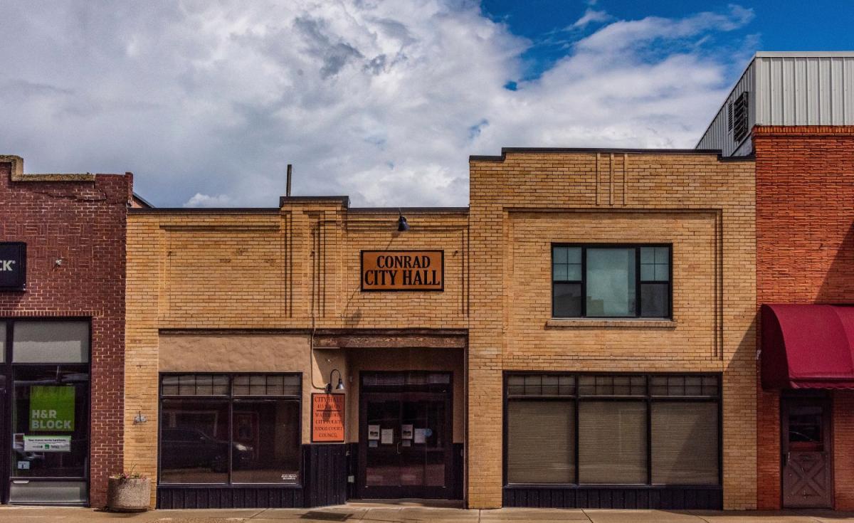
Of the two "Historic Places" in Conrad, one is the City Hall on 4th Avenue SW. Built in 1913, it still serves as City Hall and is the oldest government building in the county. Froggie's Stopping Place on the Whoop Up Trail (don't ya love that name?) has a restricted address, but is in the vicinity of Conrad. In the past it has been known as Lucille and Midway Station. The site dates from 1870, the Whoop Up Trail itself from 1869. The Whoop Up Trail was a 200-mile trading route between Fort Benton, Montana, and various trading posts near today's Lethbridge, Alberta. In its early days, traders took alcohol north to trade for buffalo robes. In its later days, during prohibition, the alcohol flowed south. With today's highways, Conrad is roughly the midway point between the two ends of the trail, and while the trail is fading back into the grasslands, Conrad celebrates Whoop Up Days every June.
Like many of their southern compatriots, Virginia brothers William G. and Charles E. Conrad moved west after the Civil War. Their travels took them to St. Louis where they boarded a steamboat bound for the end of the line—Fort Benton, Montana Territory. Fort Benton was good to the brothers. In time, they owned a thriving mercantile business, a fleet of freight-hauling steamboats operating between St. Louis and Fort Benton, and a lot of land, including a 200,000 acre cattle operation in what is now Pondera County.
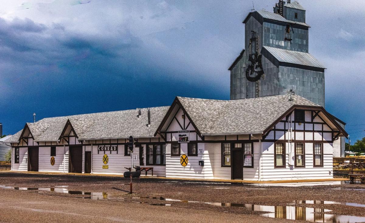
At roughly the same time, two railroad magnates sought to connect the coal mines of Alberta with smelters in Great Falls. Sir Alexander Galt, founder of Lethbridge, Alberta, was the first to complete the road which on the US side of the border had the name Great Falls and Canada Railroad. The line ran from Sweet Grass to just west of Great Falls, roughly parallel to today's Interstate 15. In 1901, Galt's competitor, the Empire Builder James J. Hill, bought Galt's line, adding it to his Great Northern.
In 1903, the Conrad Investment Company (another Conrad Brothers enterprise) deeded 600 acres adjacent to the railroad and the town of Conrad was born. The town grew quickly, with churches, hotels, shops, and of course saloons, and when the surrounding area became Pondera County in 1919, Conrad became the county seat. Today it is a pretty town of 2,318 residents (2020 US Census), and while the railroad is history, the town is served by two exits off Interstate 15 as well as Montana Secondary 534. It is the home of Montana's Lieutenant Governor, Kristen Juras.
And as for the Conrads, Charles E. moved further west and founded the city of Kalispell where he built his family home, now a Kalispell city park and museum known as the Conrad Mansion. He also started a bison breeding program that grew into the herd that formed the National Bison Range at Moiese, Montana.
Conrad is the only incorporated city in Pondera County, but 17 miles to the northwest (24 miles if you drive) is Valier, the only incorporated town in the county. Looking at Valier's history takes us back to the Conrad brothers and their 7 Block Ranch. A fellow from LaCrosse, Wisconsin named Cargill met the Conrads and bought the 7 Block Ranch for $1,000,000 (over $36,000,000 today). Cargill was instrumental in building the 20-mile long Montana Western Railway which ran from Conrad to the town named for the railroad's construction supervisor, Peter Valier. The town was incorporated in 1909 and is served by Montana Highway 44, which connects it to US 89 and Interstate 15. The 2020 Census counted 530 residents.
In addition, Pondera County has fourteen census-designated places and other unincorporated communities, few of which have more than 100 residents. Heart Butte, on the Blackfeet Reservation, is the largest with a 2020 population of 621. Five of these census-designated places are Hutterite Colonies with a combined population over 700. Roughly one-tenth of Montana's Hutterite population lives in Pondera County.
Pondera County, like most of Montana, is rural. The 2022 Census of Agriculture counted 435 farms in the county, covering 746,528 acres. Wheat accounts for 170,703 acres and barley an additional 65,459. This should not surprise us in the heart of Montana's Golden Triangle. What did surprise me is that of fifty-five counties that produce poultry and eggs, Pondera County is second. And of fifty-two counties that produce hogs and pigs, the county is second again. (Cascade County is first in hogs and pigs, and Glacier County is first in poultry and eggs.)












Leave a Comment Here