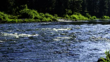
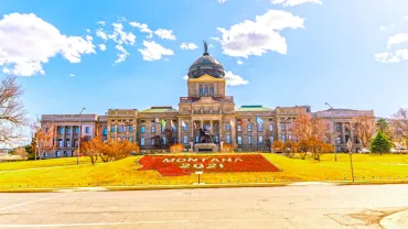
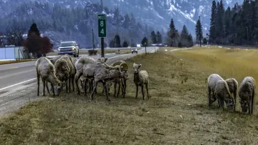
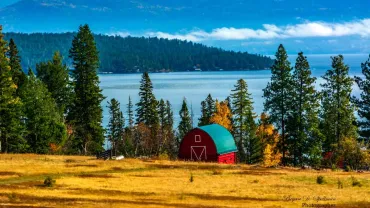
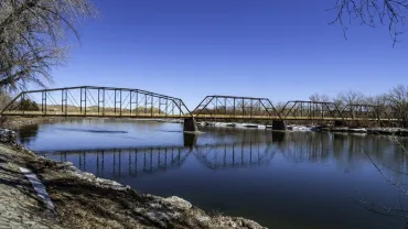
Norman Maclean was not born in Montana, nor did he die here. His published work is slim, especially when compared to A.B. Guthrie or Ivan Doig. But I wager that if you asked people what piece of writing best exemplifies Montana, many would respond A River Runs Through It.
Gold attracted people to the region, and Helena’s “main street” is a memorial to the early prospectors. Much of Last Chance Gulch is a pedestrian mall, and the turn-of-the-century architecture lining the sidewalks attracts the eye, just as the various window displays attract shoppers.
Topographically, Wibaux County is mostly prairie, but not plain in the dull sense. The land rolls, breaks, drops, and cuts into coulees and badlands formations. The website Peak Visor lists eleven "mountains" in Wibaux County. Note that the tallest of these "mountains" is less than 3,100 feet, and the most prominent rises only 443 feet above the valley floor.
Perhaps the most famous resident of Sanders County is David Thompson. Sent by the British Crown with the aim of beating Lewis and Clark to the Pacific, Thompson has been described as the most important geographer you’ve never heard of. He founded a trading post near the town that bears his name, Thompson Falls, the seat of Sanders County, and many other county features bear his name.
With the exception of 1970, Powder River County has lost population every decade since 1930, when 3,909 folk lived in the county. That count placed it at number 46 in the state, but somehow the county ended up with 9 on its license plates.
Sixteen miles south of Florence by US Highway 93 lies Victor, named for Salish Chief Victor, who as a youth met Lewis and Clark at Ross’s Hole. Today’s Victor is home to Hamilton House, an authentic Scottish pub serving the best fish and chips I have ever had. And if you are an aficionado of Scotch whiskey, the bar has one of the widest selections this side of Scotland.
The Great Northern Railroad, building its way west, reached Kalispell in 1892, and built their depot at the north end of downtown. In 1904, the railroad moved its main line north to Whitefish, leaving Kalispell to be served by a spur line only.
In size, Lake County ranks 46th among Montana counties. With a 2024 estimated population of 33,403, the county is ninth in the state. Almost sixty-eight percent of the County's land area lies on the Flathead Indian Reservation. Polson, at the southwestern corner of Flathead Lake is both the largest city and the County Seat.
The National Carousel Association publishes an online Index of North American Carousels. That index lists seven carousels in Montana, including merry-go-rounds in Boulder, Butte, Columbia Falls, Helena, Missoula, Shelby and Somers.
Born at the height of the homesteading boom (October 4th, 1920), Golden Valley County with its chamber of commerce name promised rich harvests, presumably of golden wheat, but the climate didn't live up to the farmers' needs, and the county's population has dropped fairly consistently since its first census in the county's tenth year. The 2020 census counted 823 residents, the lowest number in the county's history, but the 2024 estimate does show a 5% increase to 863, still lower than any previous census.
Alas, that site indicates that it has no information on Crackerville but does mention Gregson being two miles away. Gregson I’ve heard of. There is even an I-90 exit for Gregson, which takes you to Fairmont Hot Springs.
With the creation of Montana Territory in 1864, all land east of Bozeman Pass was called Big Horn County. So few settlers lived in this vast area that the entire eastern part of the state fell under Gallatin County's jurisdiction.
Roughly 15 miles south of Chinook, you will find one unit of the Nez Perce National Historic Park. The park, also known as the Nee-Me-Poo Trail, commemorates the 1877 trek made by 750 Non-Treaty Nez Perce Indians from Joseph, Oregon to the Bears Paw Mountains.
Toston, like Radersburg, owes its existence to the gold mines in the nearby hills. The Toston Smeltering Company processed ore for a short period in the late 1800s, but that was long enough to bring in a population that stayed on and farmed the area.
Of special note is the Chouteau County Court House. Built in 1883, to replace the original court house destroyed by fire that year, today the building is the second oldest court house still serving that function in the state of Montana.
Roughly halfway between Lame Deer and Colstrip, the Deer Medicine Rocks are a National Historic Landmark, located on private property with no public access. The landmark memorializes the site where Lakota Chief Sitting Bull had a vision foretelling his success over the U.S. 7th Cavalry led by General George Armstrong Custer.
Located at the geographical center of the state of Montana, Fergus County was formed on March 12, 1885, with land taken from Meagher and Chouteau Counties. James Fergus, a territorial delegate from Meagher County, proposed the new county, and it was named for him.
Carbon County has sixty-six listings on the National Register of Historic Places, including eleven in Red Lodge. The county courthouse and the former Carbon County Hospital and Sanitorium are both part of the Red Lodge Historic Commercial District.
On August 30, 1920, the Montana Legislature took the western part of Sheridan County and the northeastern portion of Valley County to create Daniels County. Named for local rancher Mansfield Daniels, the County covers 1,426 square miles, almost all that land.